Whernside via Ribblehead Viaduct
North Yorkshire
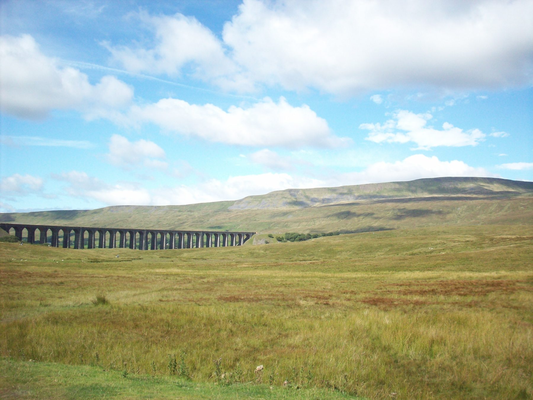
Whernside via Ribblehead Viaduct is the signature Yorkshire Dales hill walk, and it is a dog friendly outing provided your dog is fit, sure-footed and happy on a lead. From the free Ribblehead car park you head north past the 24 arches of the viaduct, climb steadily alongside Force Gill waterfall and continue up to the long, windswept ridge that tops out at 736 metres, the highest point in Yorkshire.
The descent is steeper and can be loose underfoot before the path drops into pasture for the final stretch back under the viaduct. Sheep graze the open fell throughout the year, so leads are needed from the field boundary onwards, and the summit ridge is fully exposed with no shelter and no water. There is a good-sized free car park at Ribblehead, the Station Inn for refreshments at start and finish, and a seasonal snack van during the warmer months.
At a Glance
Walk Must-Haves

Elite Paws Luxury Dog Drying Coat
£28.99 View on Amazon
LumoLeaf Portable Dog Water Bottles
£24.29 View on Amazon
Mud Daddy 8L Portable Pet Washing Device
£49.99 View on Amazon
OneTigris Tactical Dog Harness
£38.99 View on Amazon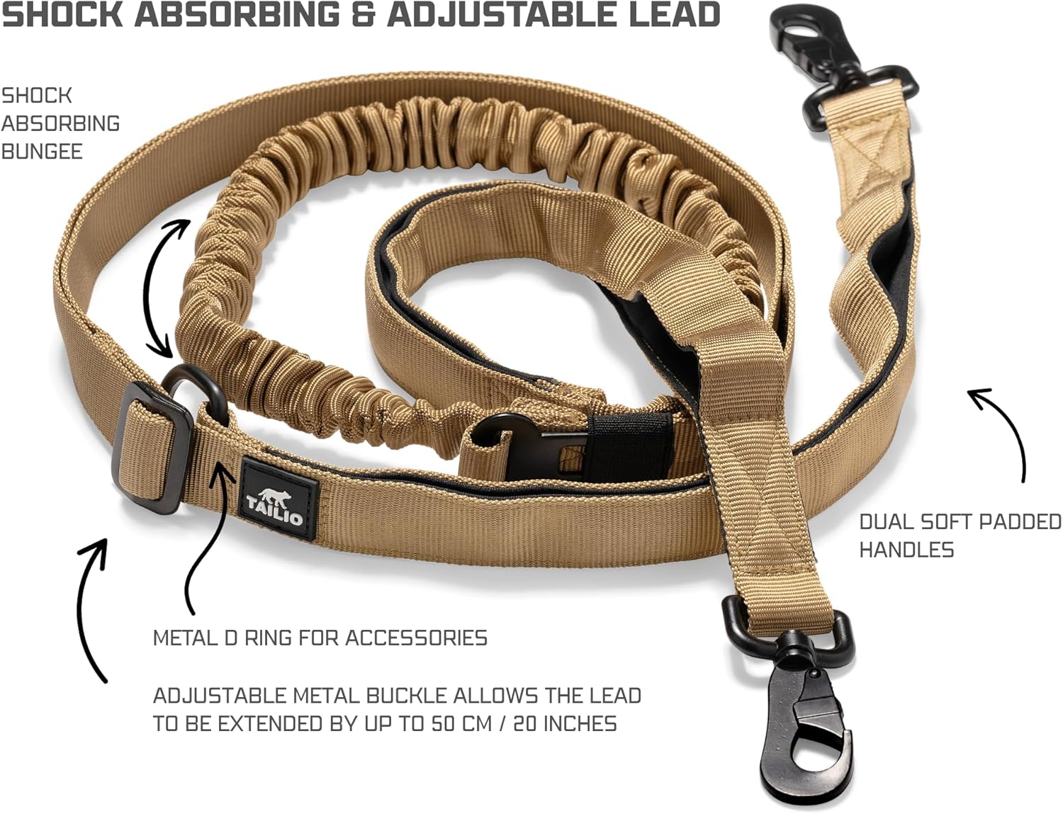
Hands Free Lead
£29.95 View on Amazon
Dog Treat Pouch
£9.99 View on AmazonAs an Amazon Associate we earn from qualifying purchases.
Frequently Asked Questions
Whernside via Ribblehead Viaduct is dog friendly, though it earns a 6 out of 10 on our rating — it's a serious hill walk rather than a gentle stroll. It's best suited to dogs that are fit, sure-footed and comfortable on a lead, so it's worth being honest about your dog's fitness and experience before heading up.
Off-lead time is limited on this route. Sheep graze the open fell throughout the year, so leads are required from the field boundary onwards, which covers much of the climb, the exposed summit ridge and the descent into pasture.
The summit ridge sits at 736 metres and is fully exposed, with no shelter and no water available up top, so pack enough water for both of you and be prepared for wind and changing weather. The descent can be loose underfoot, which is worth bearing in mind for dogs less used to rough terrain. On the plus side, there's a free car park at Ribblehead (LA6 3AS), the Station Inn serves food and drink at the start and finish, and a seasonal snack van operates in the car park during summer.
Visitor Reviews
No reviews yet. Be the first to share your experience.