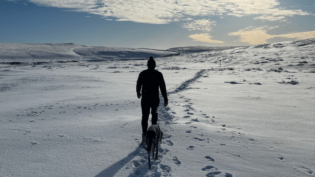

The Yorkshire Dales is one of the most varied walking landscapes in England, and for dogs it is close to unbeatable. Limestone valleys rise to moorland summits, rivers carve through ancient gorges, and the network of well-marked paths connects some of the most dramatic scenery in the north. Whether your dog is a fell runner or a gentle ambler, the Dales has a route for them.
This is also a landscape with real seasonal character. Curlews cry over open moorland from spring onwards, wildflowers push through limestone cracks in early summer, and the becks run full and fast after autumn rain. The walks in this guide span the full length of the park, from the broad sweep of Wensleydale in the north to the limestone country around Malham in the south, giving a proper cross-section of everything the Dales has to offer on four legs.
Malham Cove, Gordale Scar & Janet’s Foss
Rating: 9/10 — This iconic circular from Malham village packs limestone gorges, woodland waterfalls and sweeping pavement views into one of the most spectacular walks in the Yorkshire Dales.
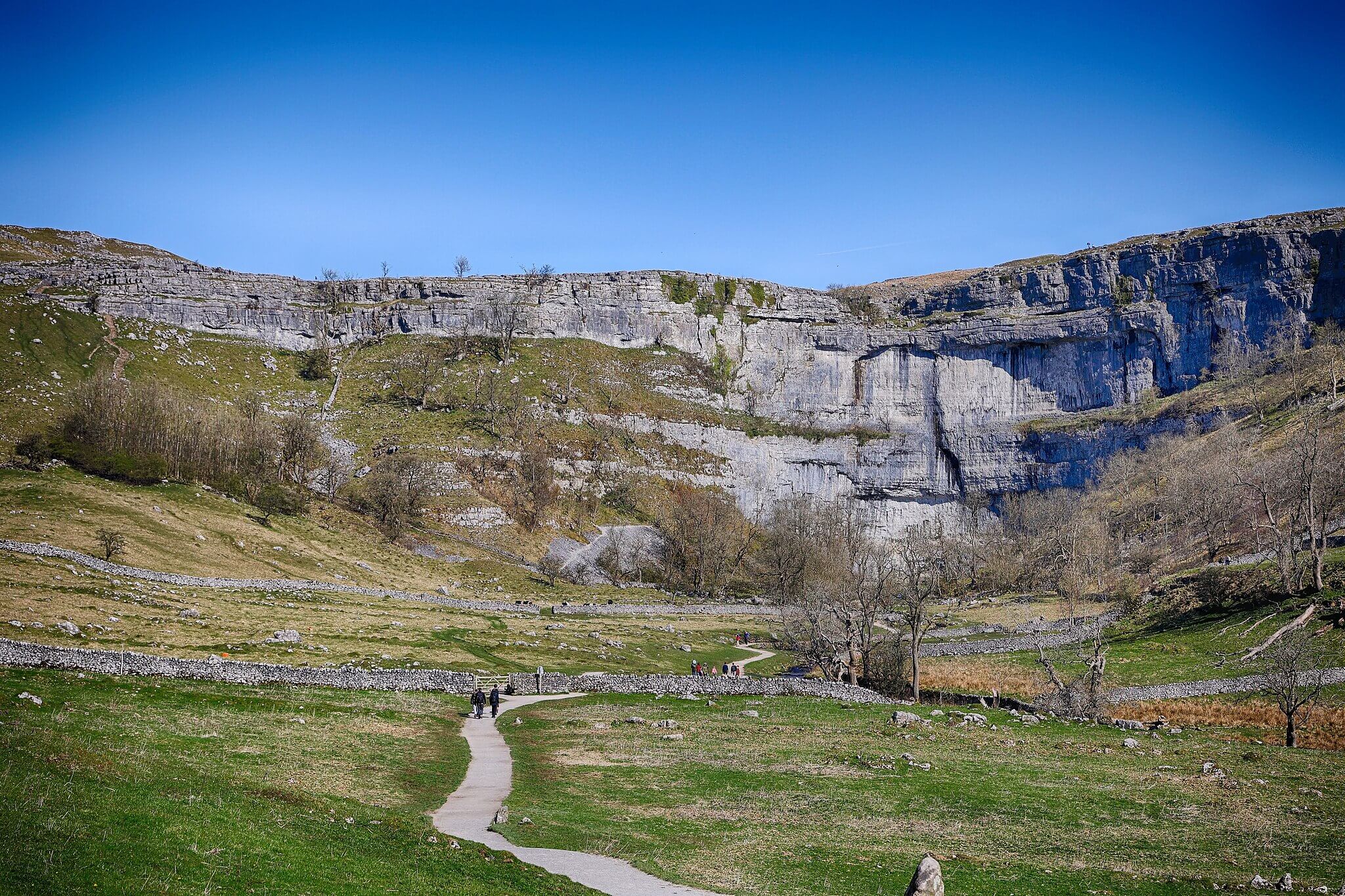 Malham Cove – Photo Credit: Tom Corser
Starting from the National Park car park in Malham village, the route heads out through meadows to Janet’s Foss, a mossy woodland waterfall with a clear plunge pool, before entering the towering limestone gorge of Gordale Scar, where overhanging crags close in and a waterfall crashes down the back wall. From Gordale the route climbs to open limestone moorland, then descends via the dry valley beneath Malham Cove, finishing across the famous limestone pavement at the top of the 80-metre cliff face. The walk covers 8.2 km with around 320 metres of ascent. Note: as of late 2025 a partial closure affects the Gordale Scar ascent due to rockfall — check the Yorkshire Dales National Park website before visiting.
Dogs move through three distinct environments on this route: damp woodland and wild garlic at Janet’s Foss, cold mineral spray in the gorge, and the dry chalk smell of open limestone moorland above the cove. The plunge pool at Janet’s Foss offers safe water access in calm conditions. Leads are essential through the gorge given the steep rocky scramble, and dogs must stay on leads on the limestone pavement where grykes pose a real hazard for paws. Livestock is present throughout the farmland sections. Best suited to fit, confident dogs comfortable on uneven terrain.
-
Distance: 8.2 km (5.1 miles)
-
Duration: 2 hrs 30 mins (150 mins)
-
Difficulty: Moderate
-
Elevation gain: 320 m
-
Walk Type: Waterfall, Historic, Moorland
-
Route Type: Circular
-
Terrain: Gravel paths, grassy moorland, rocky gorge, limestone pavement; slippery after rain
-
Off Lead Potential: Low
-
Livestock Potential: High
-
Parking: Malham National Park Centre Car Park, BD23 4DA. Pay and display; £3.50 up to 2 hours, £5.50 over 2 hours; cash and card
-
Facilities: Toilets at car park; Lister Arms and Old Barn Tea Room in Malham village
Tip: This is one of the busiest walks in the Dales. Arriving before 9am on summer weekends makes a significant difference to parking and trail quiet.
Aysgarth Falls and the River Ure Circular
Rating: 8/10 — A gentle woodland and riverside loop taking in all three tiers of one of Yorkshire’s most celebrated waterfall systems, with good scent work and easy terrain throughout.
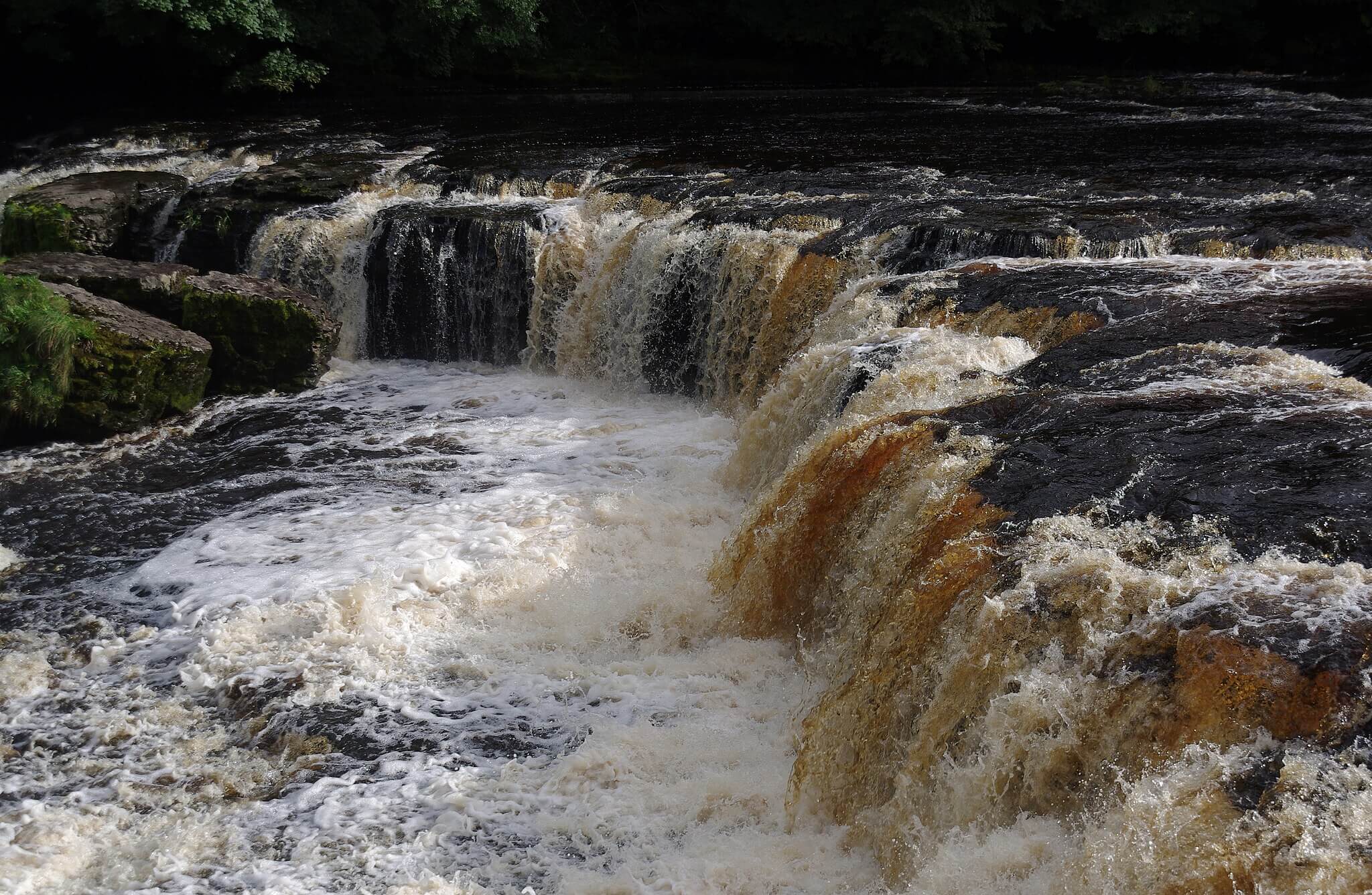 Aysgarth Falls – Photo Credit: Matt Buck
Starting from the National Park Visitor Centre car park at Aysgarth, this circular walk follows the wooded gorge of the River Ure downstream through Freeholders’ Wood, passing the upper, middle and lower falls in turn. The upper falls are wide and dramatic, thundering over broad limestone shelves, while the middle and lower falls sit deeper in the gorge, framed by mature oak woodland that blazes in autumn. The route returns via field paths above the valley, taking in views across Wensleydale, covering 7 km in total with minimal ascent.
The woodland paths here are excellent for dogs: rich river-damp scents, soft leaf litter underfoot, and the constant sound of moving water. Dogs must be kept on leads throughout, both because the riverside paths run close to the top of the falls and because livestock is present on the return field sections. There is safe water access at calmer stretches below the upper falls in dry conditions. A flat, manageable walk that suits older dogs and those not comfortable on rough terrain. The Coppice Cafe at the visitor centre makes it easy to extend the day.
-
Distance: 7.0 km (4.4 miles)
-
Duration: 1 hr 45 mins (105 mins)
-
Difficulty: Easy
-
Elevation gain: 76 m
-
Walk Type: Waterfall, Woodland, River
-
Route Type: Circular
-
Terrain: Woodland paths, grassy field paths, some riverside boardwalk; can be muddy after rain
-
Off Lead Potential: Low
-
Livestock Potential: Moderate
-
Parking: Aysgarth Falls National Park Centre Car Park, Church Bank, Aysgarth, DL8 3TH. Pay and display; £3 up to 2 hours, £5 over 2 hours; cash and card
-
Facilities: Coppice Cafe and toilets at visitor centre; Mill Race Tea Shop in Aysgarth village; Aysgarth Falls Hotel pub
Tip: The falls are at their most impressive a day or two after heavy rain, when the River Ure runs full and the lower falls come into their own.
Ingleton Waterfalls Trail
Rating: 9/10 — A privately managed circular trail through two river gorges that strings together six major waterfalls and some of the finest woodland walking in the north of England.
 Thornton Force Waterfall, Ingleton – Photo Credit: Chris Morgan
The Ingleton Waterfalls Trail starts at Broadwood Car Park at the edge of the village and follows the River Twiss upstream through Swilla Glen, past the five cascades of Pecca Falls and up to Thornton Force, where the river drops 14 metres over a limestone cliff in a single clean fall. The route then crosses open ground before descending the River Doe valley past Beezley Falls, the dramatic viewing bridge above Baxenghyll Gorge, and Snow Falls to return to Ingleton. The full circuit is 7 km with 169 metres of ascent. Note: there is an entry fee of around £11 for adults; parking is included in the ticket price.
Dogs are welcome on leads throughout, which is a trail rule rather than a site-specific requirement. The scent landscape here is exceptional: cold spray from the falls, damp limestone moss, deep oak leaf mould and the faint sweetness of river-washed stone. There is no off-lead opportunity on this trail, but the richness and variety of the environment more than compensates. The path is one-way and well-surfaced for most of its length, though some sections are stepped and rocky, making it unsuitable for dogs that struggle with uneven ground. Water access from the trail itself is very limited.
-
Distance: 7.0 km (4.4 miles)
-
Duration: 2 hrs 15 mins (135 mins)
-
Difficulty: Moderate
-
Elevation gain: 169 m
-
Walk Type: Waterfall, Woodland, River
-
Route Type: Circular
-
Terrain: Well-surfaced paths, steps, rocky sections; slippery in wet conditions
-
Off Lead Potential: Low
-
Livestock Potential: Low
-
Parking: Broadwood Car Park, Ingleton, LA6 3ET. Included in trail entry fee; approx £11 adults, £5 children; card only
-
Facilities: Cafe and toilets at Broadwood Car Park; refreshment kiosk at Beezley Farm (weekends and summer only)
Tip: The trail operates a one-way system and has set opening hours that vary by season. Check the Ingleton Waterfalls Trail website before visiting to avoid arriving outside entry times.
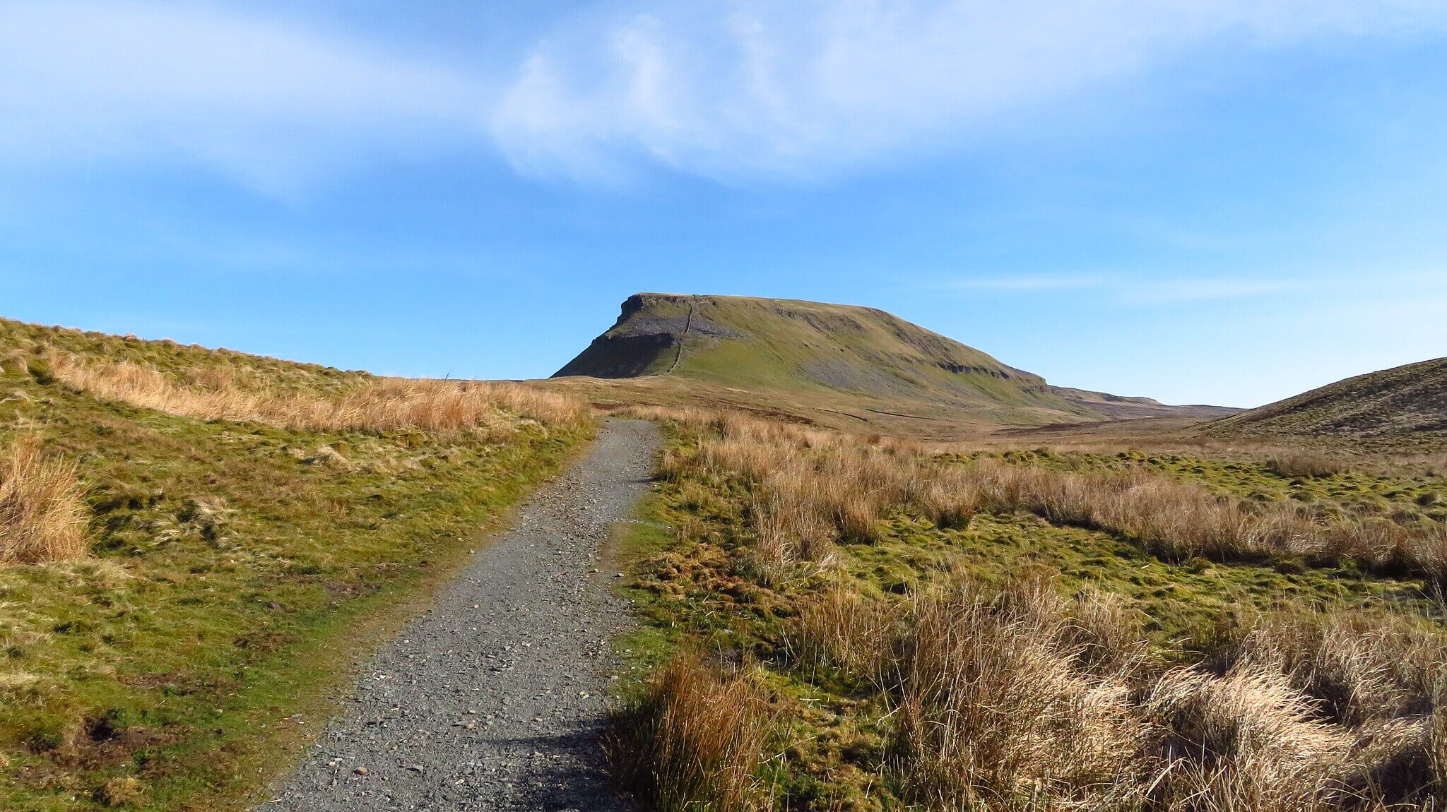
Pen-y-ghent from Horton-in-Ribblesdale
Rating: 8/10 — One of the Yorkshire Three Peaks, Pen-y-ghent offers a challenging but rewarding ridge walk with a distinctive stepped profile and exceptional views across the limestone uplands.
 Pen-Y-Ghent – Photo Credit: Richard Park
Starting from the car park in Horton-in-Ribblesdale, the route follows the lane south to Brackenbottom before climbing steeply up the mountain’s southern flank via Brackenbottom Scar. The final ascent involves a short rocky scramble up the stepped gritstone and limestone tiers that give Pen-y-ghent its distinctive silhouette. From the summit at 694 metres the Pennine Way path heads north, descending to Hull Pot, a dramatic collapsed limestone cavern, before returning along Horton Scar Lane to the village. The full circuit is 10.1 km with around 470 metres of ascent.
The open moorland scents on this walk are among the best in the Dales: peat, heather, the sweet mineral sharpness of well-drained limestone and, in summer, the faint warmth of bilberry and bent grass. Leads are essential on the summit scramble and around Hull Pot, where the open shaft presents a serious hazard and dogs must be kept well back from the edge. The approach and descent pass through farmland with livestock. A fit, confident dog is well suited to this route; less agile dogs may find the rocky scramble near the summit challenging.
-
Distance: 10.1 km (6.3 miles)
-
Duration: 3 hrs 30 mins (210 mins)
-
Difficulty: Challenging
-
Elevation gain: 470 m
-
Walk Type: Moorland, Historic
-
Route Type: Circular
-
Terrain: Grassy moorland, stone tracks, rocky scramble near summit; boggy in wet conditions
-
Off Lead Potential: Low
-
Livestock Potential: High
-
Parking: Yorkshire Dales National Park Car Park, Horton-in-Ribblesdale, BD24 0HE. Pay and display; approx £4.80 for the day; fills early on summer weekends
-
Facilities: Toilets at car park; Pen-y-ghent Cafe in village; Crown Hotel and Golden Lion pub
Tip: Pen-y-ghent Cafe operates the traditional Three Peaks clocking-in system. Clocking in and out is free, informal and entirely optional, but a nice piece of Dales walking tradition if you are completing the round.
Bolton Abbey and The Strid
Rating: 8/10 — A beautifully varied estate walk combining ruined priory, ancient woodland and the most dangerous stretch of river in England, set in the lower reaches of Wharfedale.
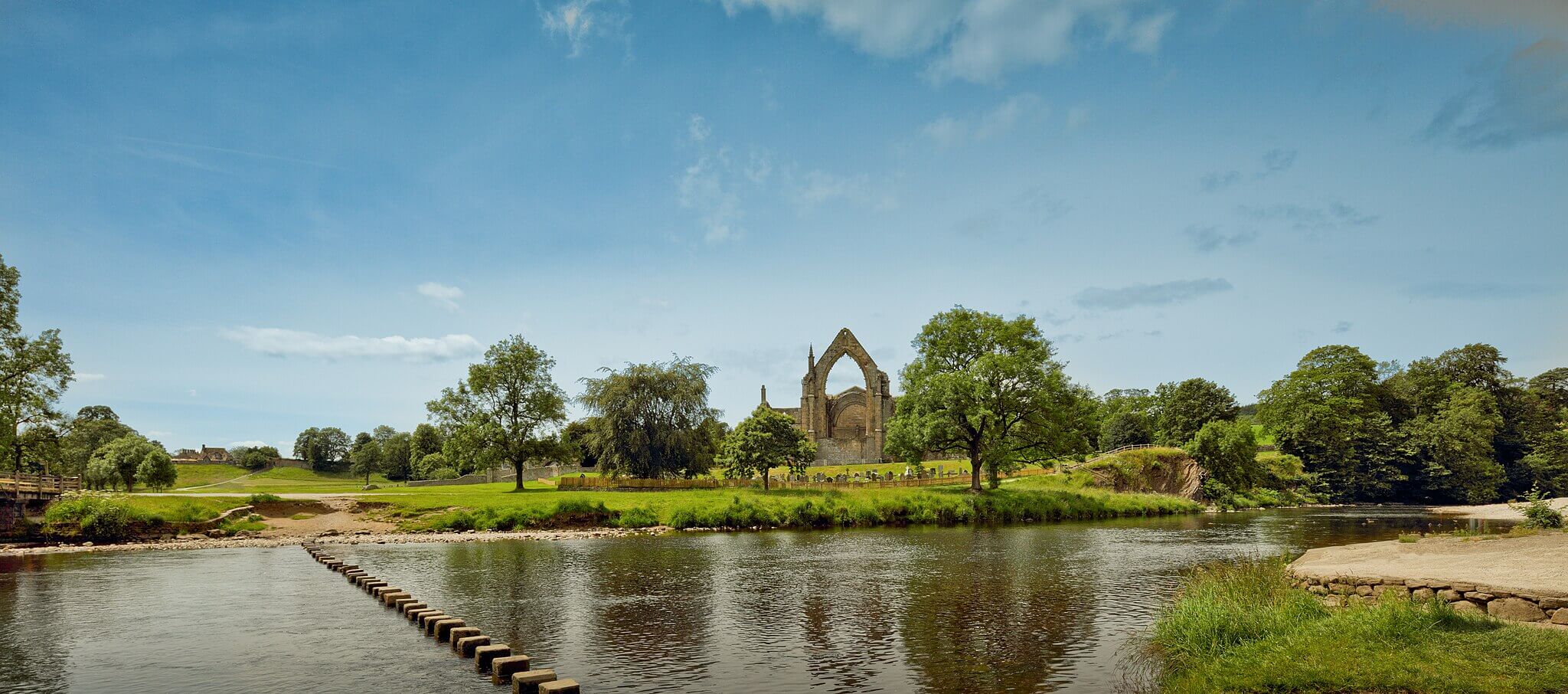 The Ruins of Bolton Abbey – Photo Credit: Michael D Beckwith
Starting from the main Bolton Abbey car park, this circular route heads riverside through the Devonshire Estate to Cavendish Pavilion and into Strid Wood, where the River Wharfe is forced through a narrow limestone channel known as The Strid. The gorge is remarkable to look at but genuinely dangerous: the current beneath the surface is powerful enough to have been fatal on numerous occasions, and the rocks are slippery. The route continues through mature woodland before looping back across open pasture with views to the priory ruins and stepping stones. The walk covers around 8 km with gentle, varied terrain.
Dogs find Strid Wood deeply absorbing, with layers of damp riverside scent, rich deciduous leaf mould and the mineral smell of wet limestone throughout. Leads are non-negotiable at The Strid itself and wherever the path runs close to the river’s edge, for safety rather than rules. The woodland sections allow more freedom on quieter days, though the estate asks dogs to be under close control at all times. Livestock is present in the meadow sections. The route suits dogs of most abilities given the gentle gradient and soft paths.
-
Distance: 8.0 km (5.0 miles)
-
Duration: 2 hrs 30 mins (150 mins)
-
Difficulty: Easy
-
Elevation gain: 120 m
-
Walk Type: Woodland, River, Historic
-
Route Type: Circular
-
Terrain: Well-surfaced estate paths, some grassy sections; generally good underfoot year-round
-
Off Lead Potential: Moderate
-
Livestock Potential: Moderate
-
Parking: Bolton Abbey Main Car Park, B6160, Bolton Abbey, BD23 6EX. Estate car park; from approx £12.50 booked online, £15 on the day; card and cash
-
Facilities: Cavendish Pavilion cafe (dog-friendly outdoor seating); toilets at car park and Cavendish Pavilion; village shop and tea rooms at Bolton Abbey village
Tip: Dogs must be kept away from The Strid at all times. The water is genuinely lethal regardless of conditions and the rocks alongside it are extremely slippery. Keep your dog on a short lead through the gorge section.
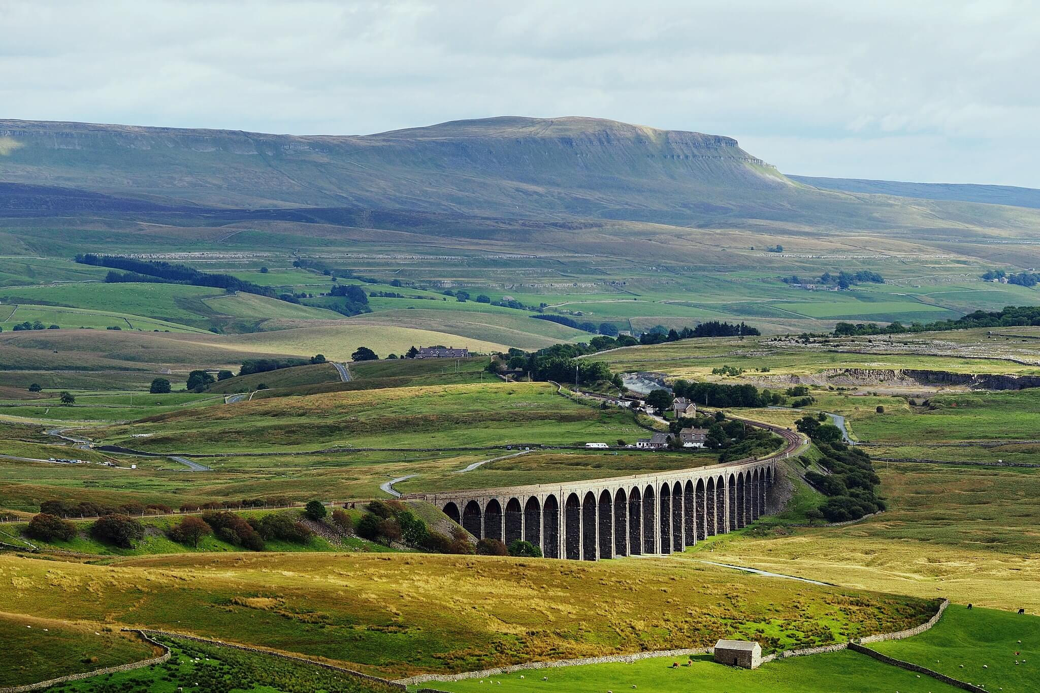
Ribblehead Viaduct and Whernside
Rating: 9/10 — A magnificent high-level circuit that combines one of England’s most iconic Victorian structures with a challenging fell walk to the summit of Whernside, the highest peak in the Dales.
 Ribblehead Viaduct – Photo Credit: Kreuzschnabel
Starting from roadside parking near the Station Inn at Ribblehead, the route sets out across open moorland alongside the Settle-Carlisle railway, passing beneath the 24 arches of Ribblehead Viaduct with its sheer scale revealed at close range. The ascent to Whernside follows Force Gill waterfall before climbing to the long ridge and summit at 736 metres, with views stretching to the Lake District fells on clear days. The descent drops steeply to Bruntscar before returning through the scattered farms of Winterscales back to the start. The full circuit is 12.9 km with 540 metres of ascent.
The high fell environment here is exceptional for dogs with a good nose: peat bog, heather, the sharp mineral edge of wet gritstone and, lower down, the sweet peaty warmth of rush-covered moorland. Leads are essential from the start given open fell sheep throughout, and the ridge itself can be exposed in any weather change. The Force Gill waterfall offers water access on the ascent. This is a challenging day out and best reserved for fit, experienced dogs comfortable with sustained ascent and rough ground underfoot.
-
Distance: 12.9 km (8.0 miles)
-
Duration: 4 hrs 15 mins (255 mins)
-
Difficulty: Challenging
-
Elevation gain: 540 m
-
Walk Type: Moorland, Reservoir, Waterfall
-
Route Type: Circular
-
Terrain: Grassy moorland, stone path on ridge, boggy sections on descent; very exposed at altitude
-
Off Lead Potential: Low
-
Livestock Potential: High
-
Parking: Roadside parking on Blea Moor Road near Station Inn, Ribblehead, LA6 3AS. Free; can fill on busy weekends; Station Inn car park also available for customers
-
Facilities: Station Inn pub at start and finish; seasonal refreshment van near viaduct
Tip: The Whernside ridge is fully exposed and weather can change fast. Even on a clear morning in the valley, carry a waterproof and check the forecast before setting out.
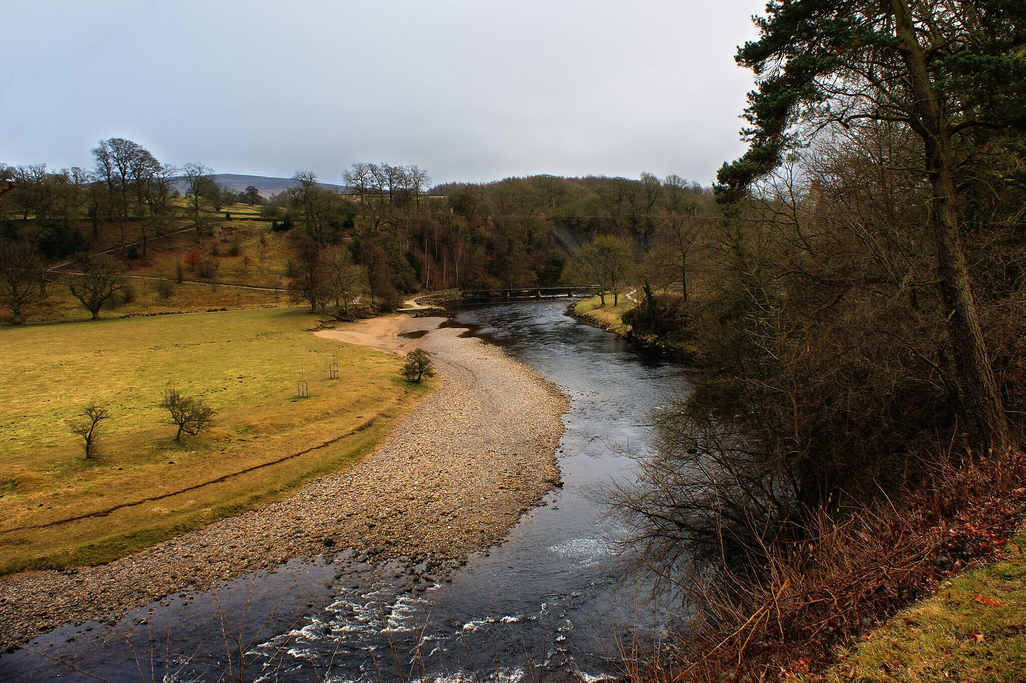
Grassington to Burnsall Circular
Rating: 8/10 — A classic Wharfedale circuit linking two of the dale’s most handsome villages via riverside Dales Way paths, limestone gorge scenery and open field walking with far-reaching views.
 The River Wharfe – Photo Credit: Ian Greig
Starting from the National Park Visitor Centre car park in Grassington, the route drops down to Linton Falls where the River Wharfe pushes through a series of limestone ledges, before joining the Dales Way for a riverside stretch southward to Burnsall. The village is one of the prettiest in the Dales, with a five-arched bridge over the Wharfe and easy paddling access at the riverside. The return leg climbs above the valley via High Lane and field paths, passing through the limestone uplands with views back down into Wharfedale before descending to Grassington. The walk is 10.8 km with around 235 metres of ascent.
The riverside sections offer layered scent work on well-drained turf and river-washed limestone, with good swimming access at Burnsall below the bridge and at Loup Scar above the village. Dogs should be on leads through farmland sections, which cover much of the route given the density of sheep and cattle in the lower meadows. The Dales Way sections alongside the river allow more relaxed walking. A well-suited walk for dogs that enjoy water access, with two distinct river spots making it worth the farmland leads.
-
Distance: 10.8 km (6.7 miles)
-
Duration: 2 hrs 45 mins (165 mins)
-
Difficulty: Moderate
-
Elevation gain: 235 m
-
Walk Type: River, historic, moorland
-
Route Type: Circular
-
Terrain: Grassy riverside paths, stone field tracks, some road walking; good underfoot in dry conditions
-
Off Lead Potential: Moderate
-
Livestock Potential: High
-
Parking: Grassington National Park Visitor Centre Car Park, Hebden Road, Grassington, BD23 5LB. Pay and display; £3.50 up to 2 hours, £5.50 over 2 hours; cash and card
-
Facilities: Toilets at car park; multiple cafes and pubs in Grassington and Burnsall; Red Lion Hotel at Burnsall is dog friendly
Tip: Burnsall is well worth a stop rather than a turnaround point. The Red Lion Hotel welcomes dogs and the riverside green below the bridge is an excellent rest spot before the return climb.
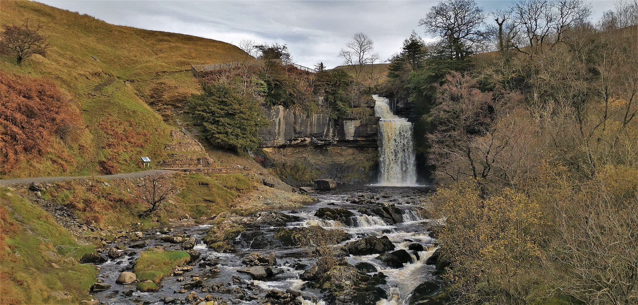
Hawes to Hardraw Force
Rating: 7/10 — A gentle farmland circuit in the heart of Wensleydale, culminating in England’s highest single-drop above-ground waterfall, tucked into a dramatic limestone amphitheatre behind a village pub.
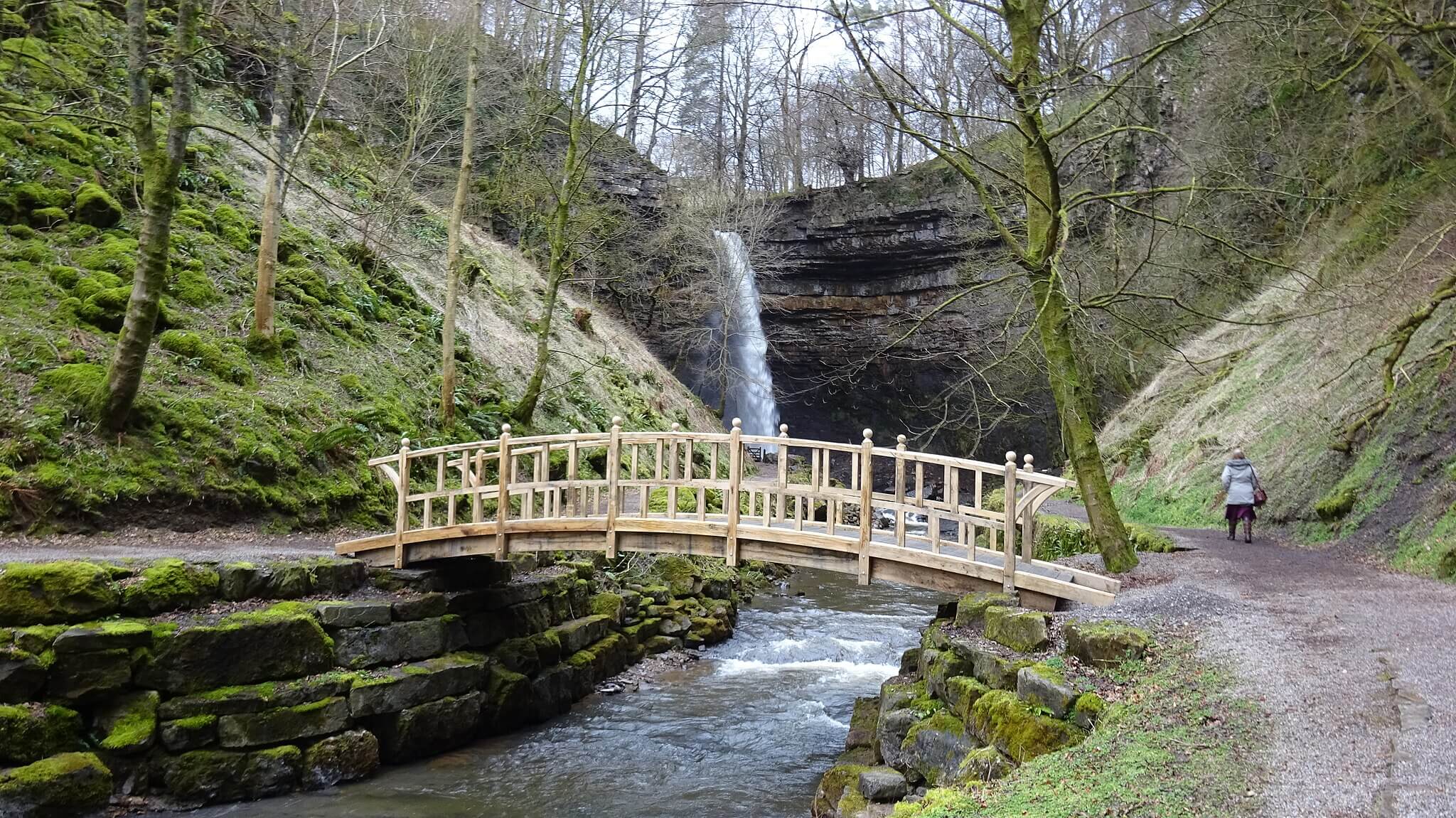 Hardraw Force – Photo Credit: Rosser1954
Starting from the National Park Visitor Centre car park in Hawes, the route follows a well-worn field path northwest across Wensleydale’s traditional hay meadows to the village of Hardraw, where access to Hardraw Force passes through the Green Dragon Inn. The waterfall drops 30 metres in a single unbroken curtain into a circular pool, with overhanging rock on three sides creating a natural concert hall that has hosted brass band competitions since the Victorian era. The route returns via field paths and farm tracks back into Hawes. The walk is 7.2 km with around 225 metres of ascent.
The hay meadows around Hawes are exceptional in early summer, dense with wildflowers and full of insect and small mammal scent. Leads are required throughout as the route passes through working farmland with livestock, including cattle in the lower meadow sections. Dogs are welcome on lead at Hardraw Force itself and at the Green Dragon, which charges a small entry fee of around £4 to access the falls. A manageable walk that suits most dogs well, with the waterfall providing a memorable destination.
-
Distance: 7.2 km (4.5 miles)
-
Duration: 2 hrs (120 mins)
-
Difficulty: Moderate
-
Elevation gain: 225 m
-
Walk Type: Waterfall, river
-
Route Type: Circular
-
Terrain: Grassy field paths, farm tracks; can be very muddy in wet conditions
-
Off Lead Potential: Low
-
Livestock Potential: High
-
Parking: Hawes National Park Visitor Centre Car Park, Station Yard, Burtersett Road, Hawes, DL8 3NT. Pay and display; cash and card
-
Facilities: Full facilities in Hawes including cafes, pubs and toilets; Green Dragon Inn at Hardraw (entry to falls through pub, approx £4 adults)
Tip: Access to Hardraw Force is through the Green Dragon Inn, which charges a small entry fee. Dogs are welcome. The entry fee goes toward maintenance of the site and is worth it for the scale of the waterfall alone.
Malham Tarn and Fountains Fell
Rating: 8/10 — A serious day walk across the high limestone moors above Malham, taking in England’s highest natural freshwater lake before climbing to the summit of Fountains Fell on a remote and demanding fell route.
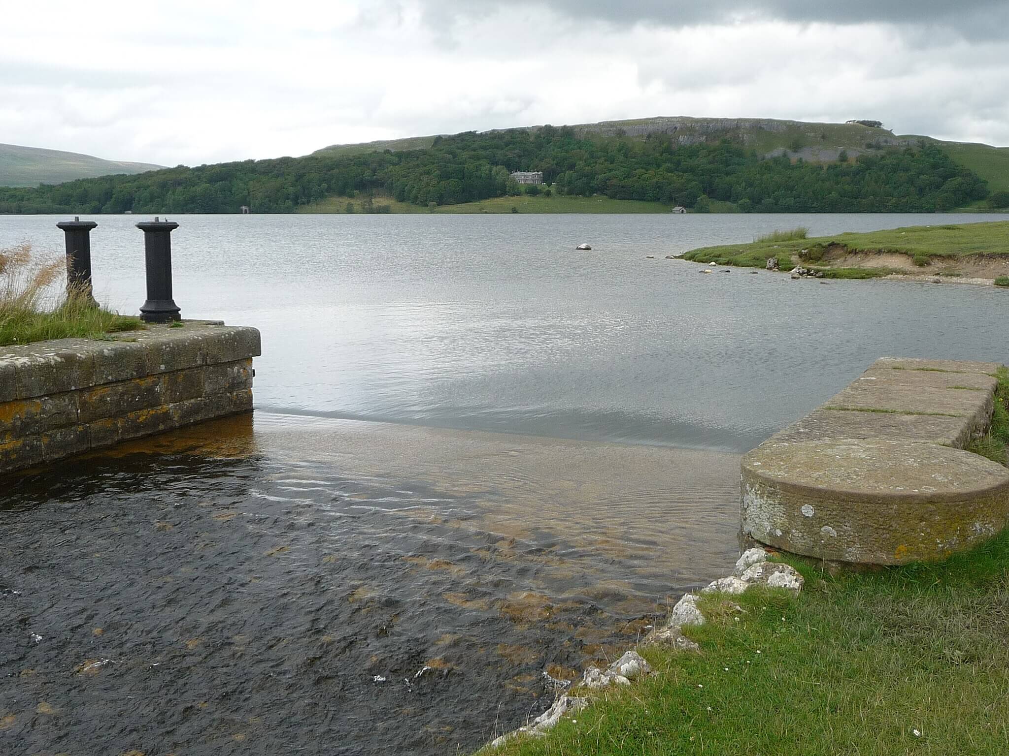 Malham Tarn – Photo Credit: Immanuel Giel
Starting from Watersinks Car Park on Malham Moor, the route follows the Pennine Way north past the glittering expanse of Malham Tarn, sitting at 377 metres in a glacially carved hollow. The path then continues via Tennant Gill Farm before the long steady ascent to Fountains Fell summit at 668 metres, with wide views across the Three Peaks country and into the Forest of Bowland on clear days. The return follows the moorland edge via Knowe Fell and the unfenced high road back to Watersinks. This is an 18.3 km walk with around 438 metres of ascent and a genuinely remote character for much of the route.
The high moorland here has a particular scent quality: dry-sweet heather, damp sphagnum, peat and the faint cold mineral smell of limestone beneath the turf. Dogs must be on leads throughout given continuous open fell sheep from the tarn onwards, particularly between March and late July when ground-nesting birds are raising young. There is no water on the later stages of the route so carry more than you think you need. This walk demands a fit, experienced dog and a full day; it is not suitable for older dogs or those with any joint issues.
-
Distance: 18.3 km (11.4 miles)
-
Duration: 5 hrs 30 mins (330 mins)
-
Difficulty: Challenging
-
Elevation gain: 438 m
-
Walk Type: Moorland, Lake
-
Route Type: Circular
-
Terrain: Grassy moorland, Pennine Way stone paths, unfenced high road; boggy in places after rain
-
Off Lead Potential: Low
-
Livestock Potential: High
-
Parking: Watersinks Car Park, Malham Moor, BD24. Free; National Trust car park; no facilities on site
-
Facilities: None on route; nearest facilities in Malham village approximately 5 km away
Tip: This is a remote route with no shelter and variable mobile signal. Check the weather carefully before setting out, carry food and water for both you and your dog, and allow more time than you think you need.
Semerwater Circular
Rating: 7/10— A quiet and undervisited circuit around North Yorkshire’s second-largest natural lake, taking in remote Raydale hamlets, open fell views and a peaceful lakeside far from the main Dales honeypots.
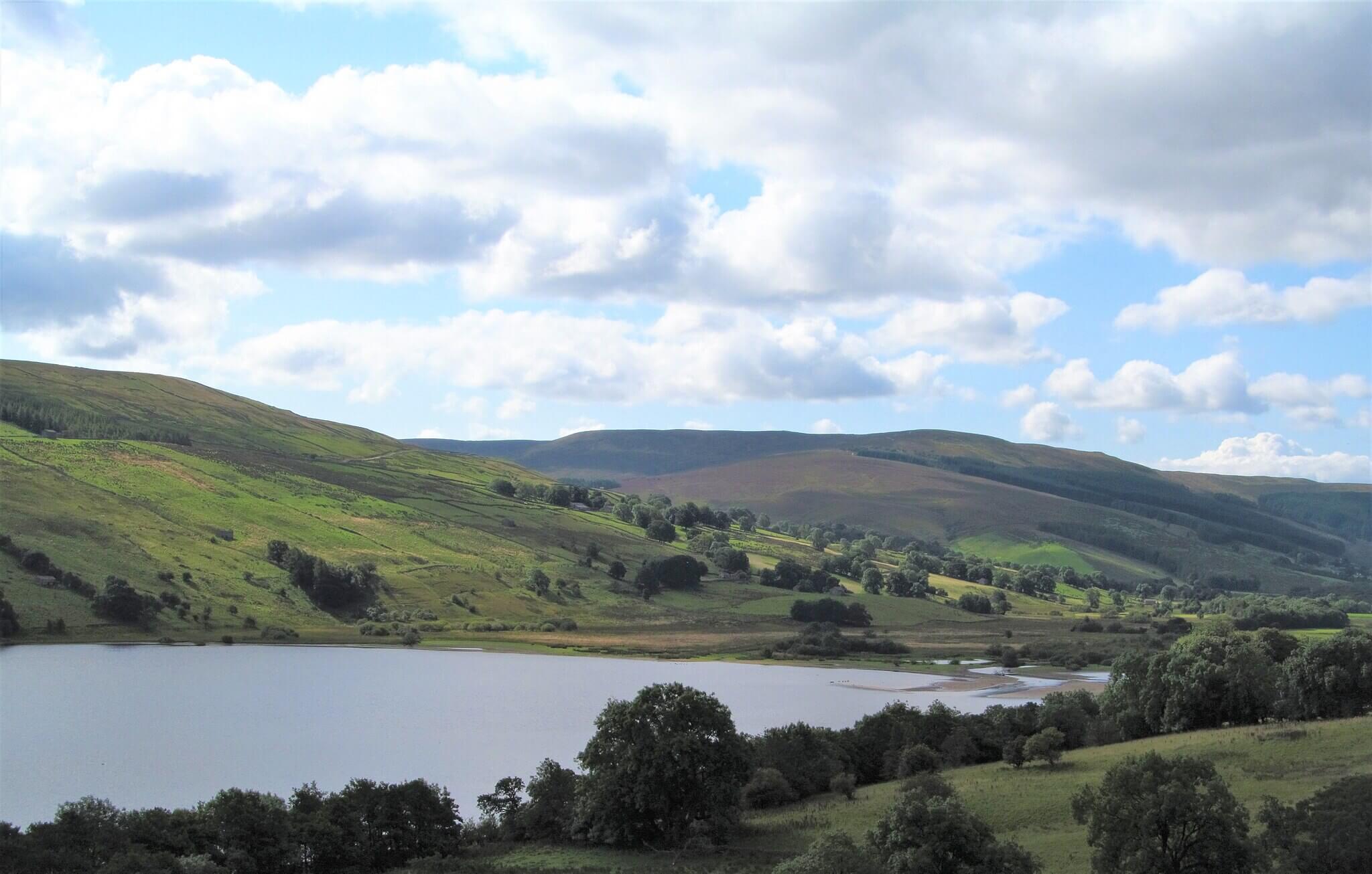 Semerwater – Photo Credit: Gordon Hatton
Starting from the lakeside parking at Low Blean Farm at Semerwater, the route follows the eastern shore and climbs away from the lake through farmland to the remote hamlet of Stalling Busk, with its ruined medieval chapel above the water. The path continues through Marsett, the smallest of Raydale’s three settlements, before crossing Cragdale Water and returning along Raydale Beck and the western lakeshore back to the start. The walk is 9.2 km with around 394 metres of ascent — more than the gentle start suggests. The circuit is quiet in a way that many Dales walks are not.
The lake edges provide excellent water access for confident swimmers, with shallow gravelly entry points at the southern end particularly suited to dogs. The scent environment here is rich and varied: lakeside reed, damp sheep pasture, moorland turf and the cool flinty smell of becks running off limestone slopes. Leads are required throughout as the route crosses working farmland with livestock at every stage. A good walk for dogs that enjoy a mix of water and open country, in a dale that rarely feels busy regardless of the season.
-
Distance: 9.2 km (5.7 miles)
-
Duration: 3 hrs (180 mins)
-
Difficulty: Moderate
-
Elevation gain: 394 m
-
Walk Type: Lake, moorland, river
-
Route Type: Circular
-
Terrain: Grassy field paths, farm tracks, some open moorland; can be wet and boggy
-
Off Lead Potential: Low
-
Livestock Potential: High
-
Parking: Lakeside parking at Low Blean Farm, Semerwater, DL8 3DJ. Informal pay at farm; approx £3 for the day; cash only; no formal car park
-
Facilities: None on route; nearest pub and facilities in Bainbridge approximately 3 km away
Tip: The parking at Low Blean Farm is on the lakeshore foreshore and managed informally by the farmer. Take cash, as there is no card payment. On busy summer days the shore can fill up; arriving before 10am gives you the pick of the spots.
Map of Dog Friendly Walks and Hikes in the Yorkshire Dales
- Malham Cove, Gordale Scar and Janet’s Foss
- Aysgarth Falls
- Ingleton Waterfalls Trail
- Pen-y-ghent from Horton-in-Ribblesdale
- Bolton Abbey and The Strid
- Ribblehead Viaduct and Whernside
- Grassington to Burnsall Circular
- Hawes to Hardraw Force
- Malham Tarn and Fountains Fell
- Semerwater Circular
- Grassington to Burnsall
- Aysgarth Falls and the River Ure Circular
- Malham Cove, Gordale Scar & Janet’s Foss
The ten walks in this guide are spread across the full length of the park, from Semerwater and Aysgarth in the north to Malham and Bolton Abbey in the south, with the Three Peaks country at the centre. Use the map below to get a sense of the geography before choosing your route, and to plan combinations if you are spending more than one day in the area.
Explore more dog friendly locations, including hikes, campsites and road trips on our Wildpack Map, our curated and ever growing map of locations to explore with your dog.
Tips for Walking in the Yorkshire Dales with a Dog
- Livestock is everywhere, all year round: The Dales is working farmland from valley floor to fell summit. Keep your dog on a lead whenever livestock is visible, even on open access land. During lambing season (roughly March to May) and the ground-nesting bird season (March to end of July), be particularly vigilant on open moorland.
- The Strid at Bolton Abbey is genuinely dangerous: This narrow channel on the River Wharfe has been fatal on many occasions. The current beneath the surface is deceptively powerful and the rocks are perpetually slippery. Keep your dog on a short lead at The Strid regardless of conditions.
- Water is abundant but not always safe: Becks and rivers run fast after rain and many have steep-sided banks. Supervise dogs around all watercourses, particularly on fell walks where the ground drops away sharply after rain. Malham Tarn and Semerwater both offer safe shallow entry points.
- Hull Pot near Pen-y-ghent is a serious hazard: This large collapsed limestone cavern on the descent from Pen-y-ghent is unfenced. Keep dogs on a lead and well back from the edge; a fall into the shaft would be unrecoverable.
- High fell weather changes fast: Walks like Whernside, Pen-y-ghent and Fountains Fell are at altitude and fully exposed. Even on warm valley days, conditions on the summit can be cold, wet and windy. Check the mountain weather forecast, carry waterproofs, and always bring water for your dog on longer routes.
- Entry fees apply at some sites: Ingleton Waterfalls Trail charges an entry fee of around £11 per adult, with parking included. Hardraw Force is accessed through the Green Dragon Inn for around £4. Budget for these before you set out.
What’s Nearby?
If you are looking to branch out from the Yorkshire Dales, there are plenty of excellent dog friendly walking areas within easy reach:
- Dog friendly campsites in The Yorkshire Dales
- Yorkshire Dales and North York Moors road trip
- Dog friendly beaches in Yorkshire
- Dog friendly walks in the North York Moors
- Dog friendly walks in The Forest of Bowland
- Dog friendly walks in the Lake District
- Dog friendly walks in the Peak District
- Dog friendly walks in Ripon
- Dog friendly walks in Derbyshire
- Dog friendly walks in Lancashire
A great way to keep discovering new landscapes while giving your dog plenty of variety under their paws.