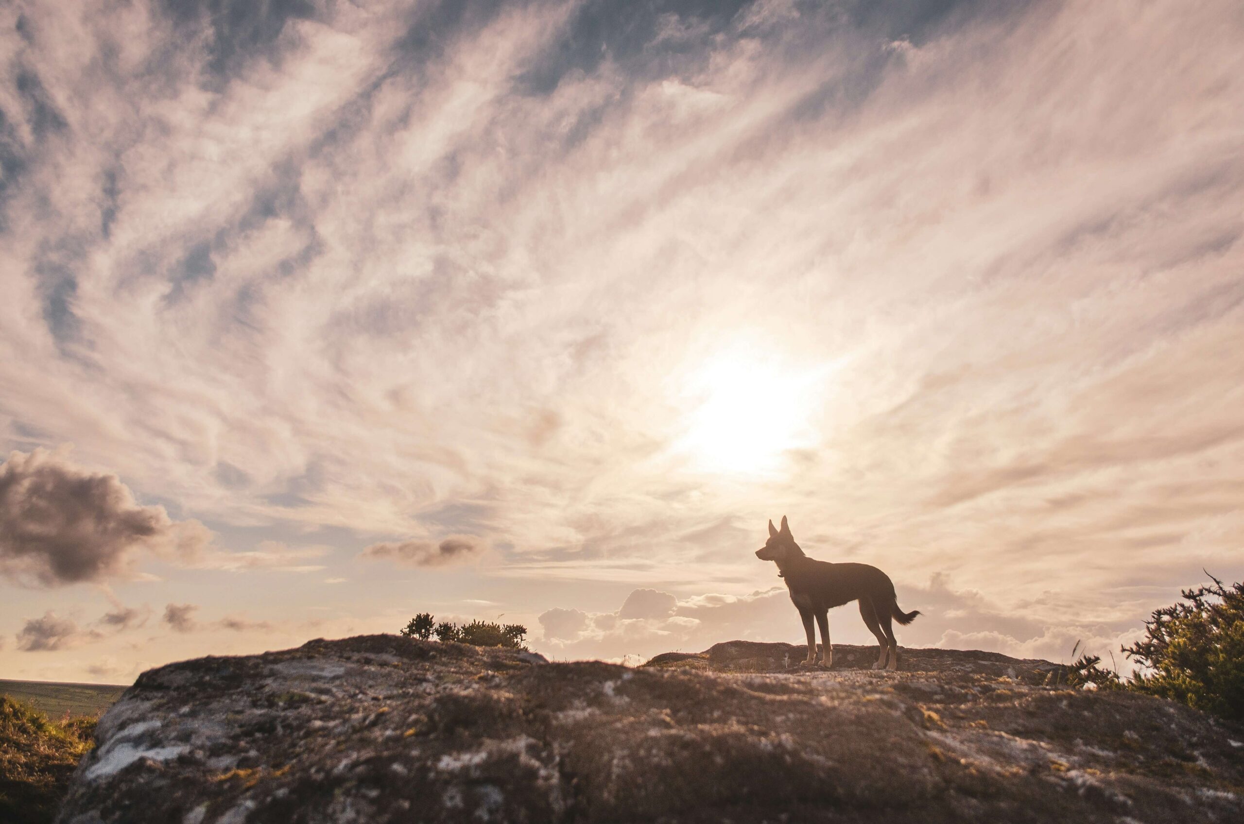

Dartmoor National Park stretches across the high moor of Devon like nowhere else in southern England, a vast granite plateau cut through by wooded river gorges, scattered with Bronze Age remains and punctuated by the distinctive rocky outcrops known as tors. For dogs, it offers something genuinely rare: mile after mile of open access land where they can run freely, rivers and streams around every corner, and terrain that changes completely from one valley to the next. The scent alone is extraordinary, the mineral sharpness of windswept moorland giving way to the deep, fungal richness of ancient oak woodland and the cool iron smell of fast-running Dartmoor water.
Knowing how to walk here with a dog does make a difference. Dartmoor’s open land is also working land, grazed by sheep, cattle and the native Dartmoor ponies that move freely across the moor year-round. Between 1 March and 31 July, dogs must be kept on a short lead across open access land to protect ground-nesting birds such as skylarks and curlews. For the rest of the year, close control is expected wherever livestock are present, and that applies across the majority of these routes.
Teign Gorge and Castle Drogo Circular
Dog Friendliness: 7/10 — Outstanding scenery and excellent river access, but dogs must be kept on leads throughout the Castle Drogo estate and wherever livestock are grazing along the route.
")
The Teign Gorge and Castle Drogo Circular begins at the National Trust car park above the gorge and descends via the Hunter’s Path to the River Teign at Fingle Bridge, covering 7.6 km (4.7 miles) with 227 m of elevation gain. The route follows the ancient gorge rim with wide views across a canopy of oak and beech before dropping to river level beneath the granite bulk of Sharp Tor. The return from Fingle Bridge runs along the Foresters Track on the south bank, a wide sheltered path alongside fast-moving water all the way back to the suspension bridge and the final climb to Castle Drogo.
The riverbank sections are the highlight for dogs, with the Teign running clear and quick over granite boulders and offering paddling access at multiple points along both banks. The air in the gorge carries the mineral coolness of running water mixed with the damp, mossy smell of old oak woodland. Dogs must be kept on leads throughout, in line with National Trust requirements and to protect the deer in Whiddon Deer Park. The walk suits confident dogs comfortable on uneven terrain; the Fishermans Path alternative over Sharp Tor includes steep steps.
- Distance: 7.6 km (4.7 miles)
- Duration: 2 hours 30 minutes (150 mins)
- Difficulty: Moderate
- Elevation gain: 227 m
- Walk Type: Woodland, river, historic
- Route Type: Circular
- Terrain: Good maintained paths throughout; mix of wide woodland track, rocky riverside path and open hillside; steep ascent and descent in places; muddy after rain
- Off Lead Potential: Low
- Livestock Potential: Moderate
- Parking: National Trust Castle Drogo car park, EX6 6PB. Free for NT members; non-members £4 for 4 hours, £7.50 all day
- Facilities: NT cafe and toilets at Castle Drogo (seasonal); Fingle Bridge Inn midway
Tip: The Fishermans Path on the north bank is the more dramatic return option, crossing the rocky base of Sharp Tor with steep steps and metal railings. The Foresters Track on the south bank is quieter, flatter and easier underfoot. Both return to the same point at the suspension bridge.
Bellever Forest and Bellever Tor
Dog Friendliness: 8/10 — A brilliant mix of forest and open moorland with river access. Dogs should be kept on leads around the picnic area near the car park where ponies graze.

Bellever Forest and Bellever Tor Circular is a 4 km (2.5 miles) route starting from the Forestry England car park at Bellever village, running south through plantation tracks before opening onto moorland for the short, rewarding climb to Bellever Tor at 443 m. The route takes in Bronze Age remains including cairn circles, cists and the Lakehead Hill stone rows before looping back through the forest edge and down to the car park via the ancient Lych Way track. Elevation gain is 126 m and the paths are well-established throughout.
The East Dart River runs along the eastern edge of the forest and is easily reached from the car park for a post-walk paddle. The forest itself carries the deep resinous smell of Scots and Sitka spruce, changing abruptly to open moorland as the treeline ends, with the wind bringing the damp, peaty scent of high Dartmoor. Dartmoor ponies graze freely through the forest and onto the tor, so leads are required in their presence. The summit of Bellever Tor delivers a full 360-degree view across the heart of the national park, and suits dogs of all sizes and abilities given the gentle gradients involved.
- Distance: 5.1 km (3.2 miles)
- Duration: 1 hour 45 minutes (105 mins)
- Difficulty: Moderate
- Elevation gain: 186 m
- Walk Type: Woodland, forest, peak, moorland
- Route Type: Circular
- Terrain: Forestry tracks and moorland paths; mostly firm underfoot but boggy in wet conditions on the open moor section
- Off Lead Potential: Moderate
- Livestock Potential: High
- Parking: Bellever Forest car park, Bellever, Dartmoor, PL20 6TP. Pay and display; £1 for up to 2 hours. Card or contactless at machines, or RingGo app
- Facilities: Toilets at car park (open 9.30am–5pm); picnic area by the East Dart River
Tip: The car park closes to new arrivals at 5pm. Arrive early on summer weekends as it fills quickly, particularly during school holidays.
Walk Must-Haves


As an Amazon Associate we earn from qualifying purchases.
Haytor and Hound Tor Circular
Dog Friendliness: 7/10 — Wide open moorland, wild ponies and ancient woodland make this a memorable route, though the lack of signage means navigation requires attention and exposed sections can be very windy.

The Haytor and Hound Tor Circular is a 7.4 km (4.6 miles) route starting from the Haytor Visitor Centre car park, crossing open moorland to Haytor Rocks before following the disused 1820 granite tramway northeast past Holwell Quarry and Smallacombe Rocks. The route descends into Becka Valley through a stretch of ancient mossy woodland before climbing to Hound Tor, where the substantial ruins of a deserted medieval village sit on the northeastern slope. The return tracks south via Emsworthy Mire and back across open moorland to the car park, with 308 m of elevation gain in total.
Dogs will find this route endlessly engaging: the tramway section crosses open heather moorland carrying the warm, resinous smell of gorse and the cold mineral edge of granite underfoot, while the Becka Valley woodland brings sudden shade, soft ground and the sound of running water. The moorland is open access and offers good off-lead running, but close control is essential near the Dartmoor ponies encountered frequently throughout. The final climb back to Haytor is the most exposed section and the wind can be significant even on clear days, so layers are worth carrying. This is one of Dartmoor’s best-known routes and gets busy at weekends.
- Distance: 7.4 km (4.6 miles)
- Duration: 2 hours 30 minutes (150 mins)
- Difficulty: Moderate
- Elevation gain: 308 m
- Walk Type: Peak, moorland, historic, woodland
- Route Type: Circular
- Terrain: Mixture of open moorland grass, granite tramway, woodland path and rocky ascent; no formal waymarking across most of the route
- Off Lead Potential: Moderate
- Livestock Potential: High
- Parking: Haytor Visitor Centre car park, TQ13 9XT. Pay and display via RingGo app; multiple car parks along the B3387
- Facilities: NT visitor centre with toilets and gift shop; seasonal ice cream van; Rock Inn at Haytor Vale (dog friendly)
Tip: Download an offline map before setting out. Signage is minimal across this route and the paths between Hound Tor and Emsworthy Mire are easy to lose in poor visibility.
Burrator Reservoir Circular
Dog Friendliness: 8/10 — One of Dartmoor’s most accessible and rewarding water-edge walks. Dogs must be kept on leads throughout as a South West Water requirement.

The Burrator Reservoir Circular covers 7.2 km (4.5 miles) around one of Dartmoor’s most scenic reservoirs, built in 1898 to supply Plymouth with fresh water. Starting from the roadside car park near the dam at the southern end, the route crosses the main dam wall and follows the reservoir’s edge through mixed woodland, passing the medieval ruins of Langstone Manor and crossing Narrator Brook before reaching Norsworthy Bridge at the northern end. The return follows the western shore back to the start, taking in a small waterfall on the final stretch, with 179 m of total elevation gain.
The water draws dogs immediately: the reservoir surface carries a cool, clean stillness that makes even hot days comfortable along this route. The woodland air is layered with damp leaf mould, mossy stone and the occasional sharp sweetness of conifers where the plantation sections begin. Dogs must be kept on leads throughout as a water authority requirement, and blue-green algae can affect the reservoir in warm weather, making it important to keep dogs out of the water itself during summer months. An ice cream van typically parks at Norsworthy Bridge during busy periods. The walk is ideal for older dogs or those who find moorland terrain difficult, with mostly flat, well-surfaced paths throughout.
- Distance: 7.2 km (4.5 miles)
- Duration: 2 hours (120 mins)
- Difficulty: Easy
- Elevation gain: 179 m
- Walk Type: Reservoir, woodland
- Route Type: Circular
- Terrain: Mix of woodland path, gravel track and short road sections; mostly flat; can be muddy in wet conditions on the inner paths
- Off Lead Potential: Low
- Livestock Potential: Low
- Parking: Burrator Dam car park or Norsworthy Bridge roadside parking, PL20 6PE. Free to park
- Facilities: Burrator Discovery Centre on the western shore; Royal Oak pub at Meavy village (dog friendly, 500 m from route)
Tip: In warm weather, check for blue-green algae warnings before visiting. Affected sections are signposted but it is worth checking online in advance as it can develop quickly.
Wistman’s Wood and Longaford Tor Circular
Dog Friendliness: 7/10 — Ancient, atmospheric and genuinely unlike anywhere else in England, though the boggy moorland and rocky terrain around the wood require care underfoot.

Wistman’s Wood and Longaford Tor Circular is an 8 km (5 miles) route starting from the small quarry car park opposite Two Bridges Hotel. The path heads north along the West Dart River valley on a well-worn gravel track to Wistman’s Wood National Nature Reserve, one of three ancient high-altitude oak woodlands surviving on Dartmoor. From there the route climbs northeast to Longaford Tor, where panoramic views open across the heart of the national park, before returning south via Littaford Tors and Crockern Tor to the car park. Elevation gain is approximately 100 m across mostly gentle terrain.
The wood itself is extraordinary: ancient twisted oaks draped in thick moss and fern, rooted among granite boulders, with a damp, fungal scent unlike anything found in conventional woodland. Access into the reserve is restricted to protect the ecosystem, so the route passes along the upper and lower edges. Dogs should be kept under close control through this section. The open moorland beyond the wood gives way to good off-lead running on the higher ground, with the peaty, bracken-scented air of central Dartmoor carrying strongly on clear days. The path from the car park to the wood is straightforward and well-trodden; the circuit beyond requires a basic OS map.
- Distance: 8 km (5 miles)
- Duration: 2 hours 30 minutes (150 mins)
- Difficulty: Moderate
- Elevation gain: 100 m
- Walk Type: Woodland, moorland, historic
- Route Type: Circular
- Terrain: Gravel path to the wood, then open moorland with grassy tracks; boggy in places after rain; rocky scramble terrain within the reserve boundary
- Off Lead Potential: Moderate
- Livestock Potential: High
- Parking: Two Bridges quarry car park, Two Bridges, Dartmoor, PL20 6SW. Free, limited to approximately 15 vehicles. Overflow parking available at Two Bridges Hotel at £5 (refundable on food and drink purchase)
- Facilities: Two Bridges Hotel (food and drink, dog friendly)
Tip: The quarry car park fills fast on weekends. Arriving before 9am on summer mornings is the most reliable way to guarantee a space. Weekday visits are noticeably quieter.
Teign Valley: Dogmarsh Bridge and Fingle Bridge Circular
Dog Friendliness: 8/10 — One of Dartmoor’s finest riverside walks, almost entirely shaded by ancient woodland and with excellent water access for dogs throughout.

The Teign Valley circular from Dogmarsh Bridge follows the north bank of the River Teign downstream through the National Trust’s Castle Drogo estate to Fingle Bridge, covering approximately 9.6 km (6 miles) with around 200 m of elevation gain. Starting from the limited roadside parking on the A382 beside Mill End Hotel, the route follows the Two Moors Way to Iron Bridge before continuing along the Fishermans Path through the gorge. At Fingle Bridge, the route crosses to the south bank and returns west via Drewston Wood and Hunter’s Tor, looping back to the A382 at Dogmarsh Bridge. This is the quieter, less-visited alternative to the Castle Drogo approach, and the eastern section through the gorge is particularly wild and sheltered.
The river is present almost throughout and dogs take to it immediately: the Teign runs cold and clear here with accessible banks at several points, and the scent of damp oak bark, river mud and cold running water is thick in the enclosed gorge. Salmon and brown trout run this section of river in autumn, occasionally visible at the weirs. Dogs should be on leads along the National Trust estate sections to protect ground-nesting birds and deer, and the Fishermans Path crosses rocky terrain with steep steps around Sharp Tor that require some care. This walk suits dogs with reasonable stamina; the full circuit is a solid half-day out.
- Distance: 9.6 km (6 miles)
- Duration: 2 hours 45 minutes (165 mins)
- Difficulty: Moderate
- Elevation gain: 200 m
- Walk Type: River, woodland, historic
- Route Type: Circular
- Terrain: Woodland riverside path, rocky gorge sections, steep steps on the Fishermans Path; generally good but uneven underfoot throughout
- Off Lead Potential: Low
- Livestock Potential: Moderate
- Parking: Roadside parking on the A382 at Dogmarsh Bridge, near Mill End Hotel, TQ13 8JN. Approximately 12 spaces, free
- Facilities: Fingle Bridge Inn midway (dog friendly terrace); Mill End Hotel at start point
Tip: The Fishermans Path on the north bank is the more dramatic option, crossing rocky terrain with steep steps around the base of Sharp Tor. The Foresters Track on the south bank is quieter, flatter and easier underfoot. Both return to the same point at the suspension bridge.
Haytor Quarry and Tramway Trail
Dog Friendliness: 8/10 — A short, accessible circuit with real historical interest and enough open space for a confident dog to stretch its legs. Good option for a shorter outing or as a warm-up walk.

The Haytor Quarry and Tramway Trail is a 3.4 km (2.1 miles) circular route from the Haytor Visitor Centre, climbing to Haytor Rocks before looping through the old quarry workings and returning along the preserved 1820 granite tramway. The quarry itself sits in a natural hollow with still water pooling in the old excavation pits, surrounded by the remnants of Georgian industrial machinery. Total elevation gain is 143 m and the route is well-defined throughout, making it a reliable choice in variable weather. The views from Haytor Rocks extend south to the Devon coast on clear days.
The quarry pools are a draw for dogs: sheltered, clear and usually shallow enough at the edges for a safe wade, carrying the cold mineral smell of standing granite water and the green scent of waterside sedge. The tramway section is flat and wide, running along the edge of open moorland with good off-lead potential where livestock are absent. Close control is essential near the Dartmoor ponies that graze this area freely. This is a popular route at weekends and can feel busy around Haytor Rocks, but the quarry and tramway sections thin out quickly.
- Distance: 3.4 km (2.1 miles)
- Duration: 1 hour (60 mins)
- Difficulty: Easy
- Elevation gain: 143 m
- Walk Type: Moorland, historic
- Route Type: Circular
- Terrain: Moorland grass and firm tramway track; short rocky section at Haytor Rocks; generally dry but exposed
- Off Lead Potential: Moderate
- Livestock Potential: High
- Parking: Haytor Visitor Centre car park, TQ13 9XT. Pay and display via RingGo app
- Facilities: NT visitor centre with toilets; seaso
Tip: The quarry pools can attract significant numbers of visitors on summer weekends. A Tuesday or Wednesday morning visit gives dogs the run of the quarry with very little company.
Great Staple Tor and White Tor Circuit
Dog Friendliness: 7/10 — Remote, exposed and genuinely wild walking in western Dartmoor, with excellent off-lead potential on open moorland but significant livestock throughout and a military firing range to be aware of.

The Great Staple Tor and White Tor Circular is an 11.9 km (7.4 miles) route starting from the large free car park at Pork Hill on the B3357, climbing across open moorland through Little and Middle Staple Tor before reaching Great Staple Tor at 455 m. The route continues north to Roos Tor and across Langstone Moor, where Bronze Age hut circles and the Longstone Man standing stone mark an ancient settlement site, before ascending White Tor. The return passes Cox Tor and loops south back to Pork Hill, with 408 m of total elevation gain and sections crossing the Merrivale military range, which is closed when red flags are flying.
The western moor has a different character to the eastern and central sections: broader, emptier, and carrying the raw, peaty smell of high ground that has been grazed rather than forested for thousands of years. The scent of sheep, bracken and granite minerals sits in the air throughout and dogs in good condition will find this a deeply stimulating route. Livestock is a near-constant presence and leads will be required across much of the ground, particularly approaching the farm settlements. Check the Dartmoor firing range schedule at gov.uk before visiting, as the route passes through the Merrivale range area. This is one for fit dogs and owners comfortable with open moorland navigation.
- Distance: 11.9 km (7.4 miles)
- Duration: 3 hours 30 minutes (210 mins)
- Difficulty: Moderate
- Elevation gain: 408 m
- Walk Type: Peak, moorland, historic
- Route Type: Circular
- Terrain: Open moorland throughout; grassy and tussocky underfoot; boggy in wet conditions particularly around Langstone Moor; no formal paths across much of the route
- Off Lead Potential: Moderate
- Livestock Potential: High
- Parking: Pork Hill car park, B3357, Tavistock, Devon, PL19 9LQ. Free, large capacity
- Facilities: None on route; Dartmoor Inn at Merrivale approximately 1.5 km east (dog friendly)
Tip: The Merrivale firing range to the north of the route is closed when red flags are displayed at the range boundaries. Check firing times before setting out.
Map of Dog Friendly Walks and Hikes Across Dartmoor National Park
Our handy map below marks each of these dog friendly walks across the Dartmoor National Park. Peruse our map and get more info and directions to find your next adventure.
The Great Staple Tor and White Tor Circular is an 11.9 km (7.4 miles) route starting from the large free car park at Pork Hill on the B3357, climbing across open moorland through Little and Middle Staple Tor before reaching Great Staple Tor at 455 m. The route continues north to Roos Tor and across Langstone Moor, where Bronze Age hut circles and the Longstone Man standing stone mark an ancient settlement site, before ascending White Tor. The return passes Cox Tor and loops south back to Pork Hill, with 408 m of total elevation gain and sections crossing the Merrivale military range, which is closed when red flags are flying.
The western moor has a different character to the eastern and central sections: broader, emptier, and carrying the raw, peaty smell of high ground that has been grazed rather than forested for thousands of years. The scent of sheep, bracken and granite minerals sits in the air throughout and dogs in good condition will find this a deeply stimulating route. Livestock is a near-constant presence and leads will be required across much of the ground, particularly approaching the farm settlements. Check the Dartmoor firing range schedule at gov.uk before visiting, as the route passes through the Merrivale range area. This is one for fit dogs and owners comfortable with open moorland navigation.
- Distance: 11.9 km (7.4 miles)
- Duration: 3 hours 30 minutes (210 mins)
- Difficulty: Moderate
- Elevation gain: 408 m
- Walk Type: Peak, moorland, historic
- Route Type: Circular
- Terrain: Open moorland throughout; grassy and tussocky underfoot; boggy in wet conditions particularly around Langstone Moor; no formal paths across much of the route
- Off Lead Potential: Moderate
- Livestock Potential: High
- Parking: Pork Hill car park, B3357, Tavistock, Devon, PL19 9LQ. Free, large capacity
- Facilities: None on route; Dartmoor Inn at Merrivale approximately 1.5 km east (dog friendly)
The Haytor Quarry and Tramway Trail is a 3.4 km (2.1 miles) circular route from the Haytor Visitor Centre, climbing to Haytor Rocks before looping through the old quarry workings and returning along the preserved 1820 granite tramway. The quarry itself sits in a natural hollow with still water pooling in the old excavation pits, surrounded by the remnants of Georgian industrial machinery. Total elevation gain is 143 m and the route is well-defined throughout, making it a reliable choice in variable weather. The views from Haytor Rocks extend south to the Devon coast on clear days.
The quarry pools are a draw for dogs: sheltered, clear and usually shallow enough at the edges for a safe wade, carrying the cold mineral smell of standing granite water and the green scent of waterside sedge. The tramway section is flat and wide, running along the edge of open moorland with good off-lead potential where livestock are absent. Close control is essential near the Dartmoor ponies that graze this area freely. This is a popular route at weekends and can feel busy around Haytor Rocks, but the quarry and tramway sections thin out quickly.
- Distance: 3.4 km (2.1 miles)
- Duration: 1 hour (60 mins)
- Difficulty: Easy
- Elevation gain: 143 m
- Walk Type: Moorland, historic
- Route Type: Circular
- Terrain: Moorland grass and firm tramway track; short rocky section at Haytor Rocks; generally dry but exposed
- Off Lead Potential: Moderate
- Livestock Potential: High
- Parking: Haytor Visitor Centre car park, TQ13 9XT. Pay and display via RingGo app
- Facilities: NT visitor centre with toilets; seasonal ice cream van
The Teign Valley circular from Dogmarsh Bridge follows the north bank of the River Teign downstream through the National Trust’s Castle Drogo estate to Fingle Bridge, covering approximately 9.6 km (6 miles) with around 200 m of elevation gain. Starting from the limited roadside parking on the A382 beside Mill End Hotel, the route follows the Two Moors Way to Iron Bridge before continuing along the Fishermans Path through the gorge. At Fingle Bridge, the route crosses to the south bank and returns west via Drewston Wood and Hunter’s Tor, looping back to the A382 at Dogmarsh Bridge. This is the quieter, less-visited alternative to the Castle Drogo approach, and the eastern section through the gorge is particularly wild and sheltered.
The river is present almost throughout and dogs take to it immediately: the Teign runs cold and clear here with accessible banks at several points, and the scent of damp oak bark, river mud and cold running water is thick in the enclosed gorge. Salmon and brown trout run this section of river in autumn, occasionally visible at the weirs. Dogs should be on leads along the National Trust estate sections to protect ground-nesting birds and deer, and the Fishermans Path crosses rocky terrain with steep steps around Sharp Tor that require some care. This walk suits dogs with reasonable stamina; the full circuit is a solid half-day out.
- Distance: 9.6 km (6 miles)
- Duration: 2 hours 45 minutes (165 mins)
- Difficulty: Moderate
- Elevation gain: 200 m
- Walk Type: River, woodland, historic
- Route Type: Circular
- Terrain: Woodland riverside path, rocky gorge sections, steep steps on the Fishermans Path; generally good but uneven underfoot throughout
- Off Lead Potential: Low
- Livestock Potential: Moderate
- Parking: Roadside parking on the A382 at Dogmarsh Bridge, near Mill End Hotel, TQ13 8JN. Approximately 12 spaces, free
- Facilities: Fingle Bridge Inn midway (dog friendly terrace); Mill End Hotel at start point
Wistman’s Wood and Longaford Tor Circular is an 8 km (5 miles) route starting from the small quarry car park opposite Two Bridges Hotel. The path heads north along the West Dart River valley on a well-worn gravel track to Wistman’s Wood National Nature Reserve, one of three ancient high-altitude oak woodlands surviving on Dartmoor. From there the route climbs northeast to Longaford Tor, where panoramic views open across the heart of the national park, before returning south via Littaford Tors and Crockern Tor to the car park. Elevation gain is approximately 100 m across mostly gentle terrain.
The wood itself is extraordinary: ancient twisted oaks draped in thick moss and fern, rooted among granite boulders, with a damp, fungal scent unlike anything found in conventional woodland. Access into the reserve is restricted to protect the ecosystem, so the route passes along the upper and lower edges. Dogs should be kept under close control through this section. The open moorland beyond the wood gives way to good off-lead running on the higher ground, with the peaty, bracken-scented air of central Dartmoor carrying strongly on clear days. The path from the car park to the wood is straightforward and well-trodden; the circuit beyond requires a basic OS map.
- Distance: 8 km (5 miles)
- Duration: 2 hours 30 minutes (150 mins)
- Difficulty: Moderate
- Elevation gain: 100 m
- Walk Type: Woodland, moorland, historic
- Route Type: Circular
- Terrain: Gravel path to the wood, then open moorland with grassy tracks; boggy in places after rain; rocky scramble terrain within the reserve boundary
- Off Lead Potential: Moderate
- Livestock Potential: High
- Parking: Two Bridges quarry car park, Two Bridges, Dartmoor, PL20 6SW. Free, limited to approximately 15 vehicles. Overflow parking available at Two Bridges Hotel at £5 (refundable on food and drink purchase)
- Facilities: Two Bridges Hotel (food and drink, dog friendly)
The Burrator Reservoir Circular covers 7.2 km (4.5 miles) around one of Dartmoor’s most scenic reservoirs, built in 1898 to supply Plymouth with fresh water. Starting from the roadside car park near the dam at the southern end, the route crosses the main dam wall and follows the reservoir’s edge through mixed woodland, passing the medieval ruins of Langstone Manor and crossing Narrator Brook before reaching Norsworthy Bridge at the northern end. The return follows the western shore back to the start, taking in a small waterfall on the final stretch, with 179 m of total elevation gain.
The water draws dogs immediately: the reservoir surface carries a cool, clean stillness that makes even hot days comfortable along this route. The woodland air is layered with damp leaf mould, mossy stone and the occasional sharp sweetness of conifers where the plantation sections begin. Dogs must be kept on leads throughout as a water authority requirement, and blue-green algae can affect the reservoir in warm weather, making it important to keep dogs out of the water itself during summer months. An ice cream van typically parks at Norsworthy Bridge during busy periods. The walk is ideal for older dogs or those who find moorland terrain difficult, with mostly flat, well-surfaced paths throughout.
- Distance: 7.2 km (4.5 miles)
- Duration: 2 hours (120 mins)
- Difficulty: Easy
- Elevation gain: 179 m
- Walk Type: Reservoir, woodland
- Route Type: Circular
- Terrain: Mix of woodland path, gravel track and short road sections; mostly flat; can be muddy in wet conditions on the inner paths
- Off Lead Potential: Low
- Livestock Potential: Low
- Parking: Burrator Dam car park or Norsworthy Bridge roadside parking, PL20 6PE. Free to park
- Facilities: Burrator Discovery Centre on the western shore; Royal Oak pub at Meavy village (dog friendly, 500 m from route)
The Haytor and Hound Tor Circular is a 7.4 km (4.6 miles) route starting from the Haytor Visitor Centre car park, crossing open moorland to Haytor Rocks before following the disused 1820 granite tramway northeast past Holwell Quarry and Smallacombe Rocks. The route descends into Becka Valley through a stretch of ancient mossy woodland before climbing to Hound Tor, where the substantial ruins of a deserted medieval village sit on the northeastern slope. The return tracks south via Emsworthy Mire and back across open moorland to the car park, with 308 m of elevation gain in total.
Dogs will find this route endlessly engaging: the tramway section crosses open heather moorland carrying the warm, resinous smell of gorse and the cold mineral edge of granite underfoot, while the Becka Valley woodland brings sudden shade, soft ground and the sound of running water. The moorland is open access and offers good off-lead running, but close control is essential near the Dartmoor ponies encountered frequently throughout. The final climb back to Haytor is the most exposed section and the wind can be significant even on clear days, so layers are worth carrying. This is one of Dartmoor’s best-known routes and gets busy at weekends.
- Distance: 7.4 km (4.6 miles)
- Duration: 2 hours 30 minutes (150 mins)
- Difficulty: Moderate
- Elevation gain: 308 m
- Walk Type: Peak, moorland, historic, woodland
- Route Type: Circular
- Terrain: Mixture of open moorland grass, granite tramway, woodland path and rocky ascent; no formal waymarking across most of the route
- Off Lead Potential: Moderate
- Livestock Potential: High
- Parking: Haytor Visitor Centre car park, TQ13 9XT. Pay and display via RingGo app; multiple car parks along the B3387
- Facilities: NT visitor centre with toilets and gift shop; seasonal ice cream van; Rock Inn at Haytor Vale (dog friendly)
Bellever Forest and Bellever Tor Circular is a 5.1 km (3.2 miles) route from the Forestry England car park at Bellever village, heading south through plantation tracks before opening onto moorland for the climb to Bellever Tor at 443 m. The route passes Bronze Age remains including cairn circles, cists and the Lakehead Hill stone rows before looping back through the forest edge and down to the car park via the ancient Lych Way track. Elevation gain is 186 m and the paths are well-established throughout.
The East Dart River runs along the eastern edge of the forest and is easily reached from the car park for a post-walk paddle. The forest carries the deep resinous smell of Scots and Sitka spruce, changing abruptly to open moorland as the treeline ends, with the wind bringing the damp, peaty scent of high Dartmoor. Dartmoor ponies graze freely through the forest and onto the tor, so leads are required in their presence. The summit delivers a full 360-degree view across the heart of the national park, and suits dogs of all sizes given the moderate gradients involved.
- Distance: 5.1 km (3.2 miles)
- Duration: 1 hour 45 minutes (105 mins)
- Difficulty: Moderate
- Elevation gain: 186 m
- Walk Type: Woodland, forest, peak, moorland
- Route Type: Circular
- Terrain: Forestry tracks and moorland paths; mostly firm underfoot but boggy in wet conditions on the open moor section
- Off Lead Potential: Moderate
- Livestock Potential: High
- Parking: Bellever Forest car park, Bellever, Dartmoor, PL20 6TP. Pay and display; card or contactless at machines, or RingGo app
- Facilities: Toilets at car park (open 9.30am–5pm); picnic area by the East Dart River
The Teign Gorge and Castle Drogo Circular begins at the National Trust car park above the gorge and descends via the Hunter’s Path to the River Teign at Fingle Bridge, covering 7.6 km (4.7 miles) with 227 m of elevation gain. The route follows the ancient gorge rim with wide views across a canopy of oak and beech before dropping to river level beneath the granite bulk of Sharp Tor. The return from Fingle Bridge runs along the Foresters Track on the south bank, a wide sheltered path alongside fast-moving water all the way back to the suspension bridge and the final climb to Castle Drogo.
The riverbank sections are the highlight for dogs, with the Teign running clear and quick over granite boulders and offering paddling access at multiple points along both banks. The air in the gorge carries the mineral coolness of running water mixed with the damp, mossy smell of old oak woodland. Dogs must be kept on leads throughout, in line with National Trust requirements and to protect the deer in Whiddon Deer Park. The walk suits confident dogs comfortable on uneven terrain; the Fishermans Path alternative over Sharp Tor includes steep steps.
- Distance: 7.6 km (4.7 miles)
- Duration: 2 hours 30 minutes (150 mins)
- Difficulty: Moderate
- Elevation gain: 227 m
- Walk Type: Woodland, river, historic
- Route Type: Circular
- Terrain: Good maintained paths throughout; mix of wide woodland track, rocky riverside path and open hillside; steep ascent and descent in places; muddy after rain
- Off Lead Potential: Low
- Livestock Potential: Moderate
- Parking: National Trust Castle Drogo car park, EX6 6PB. Free for NT members; non-members £4 for 4 hours, £7.50 all day
- Facilities: NT cafe and toilets at Castle Drogo (seasonal); Fingle Bridge Inn midway
Find even more adventures across the whole of the UK in our Wildpack Map, outlining our recommended dog friendly walks, hikes, campsites, road trips and much more.
Tips for Walking Dartmoor with Your Dog
- Seasonal lead rules apply across the moor: Between 1 March and 31 July, dogs must be kept on a short fixed lead (maximum 2 metres) on all open access land within Dartmoor National Park to protect ground-nesting birds including skylarks, curlews and lapwings. This applies regardless of whether livestock are present.
- Livestock are everywhere: Dartmoor ponies, sheep and cattle graze freely across the open moor year-round. Always put your dog on a lead when livestock are visible, even at distance. Dartmoor ponies in particular can kick when startled and should never be approached.
- Carry water on the high moor: The open moorland sections of Dartmoor offer little shade in warm weather. Streams and rivers are abundant at lower elevations, but tor and ridge walks can go long stretches without accessible water for dogs. Carry at least a litre on longer routes.
- Watch for blue-green algae in summer: Dartmoor’s reservoirs and some slower-moving pools can develop toxic blue-green algae blooms in warm weather. Check South West Water’s advisory pages before reservoir walks and keep dogs out of standing water if any signage is present.
- Check firing range schedules: Three military firing ranges operate within the national park. Merrivale, Okehampton and Willsworthy ranges are closed on certain days and display red flags when in use. Check the Dartmoor firing programme at gov.uk before planning walks in these areas.
- Dartmoor weather changes fast: Even in summer, conditions on the high moor can deteriorate quickly. Bring a windproof layer, download an offline map and tell someone where you are going on any route that takes you away from the road.
What’s Nearby?
If you’re exploring Dartmoor with your dog, these nearby adventures pair perfectly with a day on the moor:
- Dog friendly walks in Devon – Coastal paths, woodlands and gentle countryside walks beyond the moorland landscape.
- Dog friendly beaches in Devon – Ideal for combining open moorland walks with a coastal leg stretch for your dog.
- Dog friendly walks in Exmoor National Park – Another moorland classic, offering a different feel with wooded valleys and dramatic coastline.
- Dog friendly beaches in Cornwall – Explore the pristine beaches of neighbouring Cornwall with your dog and relax on the open sand.
- Dog friendly walks in Cornwall – Even more walks as you head towards Lands End, experience the sprawling countryside of Cornwall.