

Lancashire rewards those who look beyond the obvious. The county stretches from Irish Sea salt marsh to exposed Pennine moor, with limestone hills rising quietly above Morecambe Bay and reservoirs cutting through the West Pennines. It is varied, often underrated, and far less crowded than its famous neighbours.
Whether you want summit views, steady waterside miles or sheltered woodland trails, Lancashire delivers routes that feel properly spacious and genuinely rewarding to explore with your dog.
Rivington Pike and Terraced Gardens Circular, Chorley
")
This 5 mile 8 km circular begins near Rivington Hall Barn and climbs gradually through woodland before opening into the historic terraced gardens. Stone steps, winding paths and elevated platforms break up the ascent, giving the route structure and character rather than a relentless uphill grind.
The final pull to Rivington Pike is short and exposed, with wide views across the West Pennine Moors and towards the coast on clear days. Paths are well worn but can be muddy after rain. Sheep graze on upper slopes, so dogs should be kept under close control where livestock are present.
Distance: 5 miles / 8 km
Terrain: Woodland paths, stone steps, open moorland
Facilities: Car park, café and toilets near Rivington Hall Barn
Best for: A varied hill walk with panoramic views
Jubilee Tower and Darwen Moor Circular, Darwen
")
This 4 mile 6.4 km circular explores open moorland above Darwen, climbing steadily to Jubilee Tower. The route follows clear, broad tracks across heather and gritstone, offering a strong sense of space without complex navigation.
From the tower summit, views stretch deep into Lancashire and across the Pennines. The terrain is exposed and can become boggy after sustained rain. Livestock are sometimes present on surrounding ground, so leads are advisable when required.
Distance: 4 miles / 6.4 km
Terrain: Moorland tracks, gritstone paths
Facilities: Moorland car park at starting point
Best for: Wide open ground and big skies
Paddy’s Pole and Winter Hill Circular, Belmont

This 5.5 mile 8.8 km circular explores open moorland above Belmont, climbing steadily onto Winter Hill before reaching the landmark summit marker known as Paddy’s Pole. The route follows broad, well established tracks across heather and peat, with expansive views stretching across Lancashire, Greater Manchester and deep into the Pennines on clear days.
The terrain is exposed and can feel wild in poor weather, with little shelter from wind. Underfoot conditions vary between firm stone track and softer moorland sections that can become wet after heavy rain. Sheep and ground nesting birds are present seasonally, so dogs should be kept under close control where required.
Distance: 5.5 miles / 8.8 km
Terrain: Open moorland tracks, stone paths, exposed summit
Facilities: Car park near Belmont village
Best for: Expansive moorland views and a true Pennine feel
Arnside Knott Circular, Arnside and Silverdale
")
The 3 mile 4.8 km circular up Arnside Knott climbs through woodland before emerging onto limestone grassland and rocky outcrops overlooking Morecambe Bay. The shift in terrain gives the walk texture and a surprising sense of elevation for a relatively modest summit.
From the top, views extend across the bay towards the southern Lake District fells. Limestone sections can be slippery when wet, so steady footing is important. Livestock occasionally graze on open sections, and dogs should be managed accordingly.
Distance: 3 miles / 4.8 km
Terrain: Woodland trails, limestone paths, open hillside
Facilities: Small car park, pubs and cafés in Arnside village
Best for: Elevated bay views in a compact loop
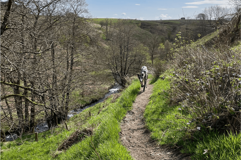
Wycoller Country Park Circular, Near Colne
")
This 4 mile 6.4 km circular explores the historic valley of Wycoller Country Park, following a clear stream past packhorse bridges and stone ruins before rising gently onto surrounding moorland.
The walking is steady and varied, combining valley paths with more open fell tracks. It rarely feels busy, even at weekends. Paths can become muddy after rain, particularly near the water. Sheep graze on higher ground, so dogs should be kept on lead where appropriate.
Distance: 4 miles / 6.4 km
Terrain: Valley paths, moorland tracks, stone bridges
Facilities: Car park and toilets at Wycoller
Best for: Peaceful valley walking with historic character
Anglezarke and Rivington Reservoir Circuit
")
This 6 mile 9.6 km loop links sections of the Anglezarke and Rivington reservoir chain, following established paths beside open water and beneath surrounding moorland. The terrain is steady, allowing you to cover distance comfortably without steep gradients.
Long views across the reservoirs create a sense of openness throughout the route. Cyclists share parts of the path, so dogs should remain under control. Water access is frequent, making this a good option in warmer months.
Distance: 6 miles / 9.6 km
Terrain: Reservoir paths, woodland tracks, open moorland
Facilities: Multiple parking points around Anglezarke
Best for: Longer, flowing waterside miles
Entwistle and Wayoh Reservoir Circular, Near Bolton
")
This 4 mile 6.4 km circular follows a quieter loop around Entwistle and Wayoh reservoirs. Woodland encloses much of the path, creating a calmer atmosphere than the busier Rivington routes.
The terrain is mostly level and well maintained, making it accessible and steady underfoot. Shaded sections are welcome in summer. Cyclists use parts of the route, so awareness is important.
Distance: 4 miles / 6.4 km
Terrain: Woodland paths, reservoir tracks
Facilities: Car park near Entwistle station
Best for: A peaceful, sheltered reservoir walk
Fairy Glen Circular, Parbold
")
This 2 mile 3.2 km circular traces a wooded valley carved by Dean Brook. Narrow paths, small waterfalls and stepping stones give the walk an intimate feel, particularly beneath dense tree cover.
It is a shorter outing, ideal for quieter days or for dogs that prefer sheltered terrain. Paths can become slippery after heavy rain. The narrow nature of sections means leads are recommended during busier periods.
Distance: 2 miles / 3.2 km
Terrain: Woodland paths, stream crossings, steps
Facilities: Limited roadside parking near Parbold
Best for: Short, atmospheric woodland walking
Lytham Green and Ribble Estuary Loop, Lytham St Annes
")
This 3.5 mile 5.6 km circular follows the promenade and grassland around Lytham Green and the Ribble Estuary, passing the historic Lytham Windmill.
The route is flat and accessible, combining paved sections with open green space. Sea air and wide estuary views define the experience. It can be breezy and exposed, but the steady terrain makes it suitable for relaxed outings.
Distance: 3.5 miles / 5.6 km
Terrain: Promenade, grassland, estuary edge
Facilities: Parking, cafés and toilets in Lytham
Best for: An easy coastal loop with open views
Clitheroe and the Forest of Bowland

The landscape around Clitheroe and the Forest of Bowland offers some of Lancashire’s most rewarding fell walking. Rolling uplands, quiet valleys and long reservoir circuits create a mix of steady climbs and scenic riverside miles, all within an Area of Outstanding Natural Beauty.
We’ve covered this region in depth in our dedicated guide to dog friendly walks near Clitheroe and the Forest of Bowland, which includes the following routes:
- Pendle Hill from Barley
- Beacon Fell Country Park
- Dunsop Bridge River Walk
- Tolkien Trail, Hurst Green
- Longridge Fell from Jeffrey Hill
- Stocks Reservoir Circular
- Nicky Nook via Grizedale
- Gisburn Forest Dog Friendly Trails
Explore the full guide for detailed route descriptions, terrain notes and facilities information.
Tips for Walking Dogs in Lancashire
- Weather: Moorland and coastal routes are exposed. Bring layers year round.
- Livestock: Sheep and cattle are common on upland routes. Always carry a lead.
- Ground conditions: Moorland paths can become boggy after prolonged rain.
- Shared paths: Reservoir circuits are popular with cyclists. Keep dogs under control.
- Tides: On estuary routes, stay clear of marsh edges and check tide times.
Map of Dog Friendly Walks in Lancashire
Use the map below to locate each walk and plan your route across the county. Click the pins to uncover more information and directions to the nearest car park.
This moorland circular climbs onto Winter Hill to reach Paddy’s Pole, a prominent summit marker with extensive views across Lancashire and Greater Manchester. The route follows broad, well established tracks.
The exposed nature of the summit gives a strong sense of elevation and space. Conditions can be windy, with softer ground in places after rain.
Route type: Circular
Distance: 5.5 miles / 8.8 km
Terrain: Moorland tracks and stone paths
Facilities: Car park near Belmont village
Best for: Expansive Pennine views
This flat coastal loop follows Lytham Green and the Ribble Estuary, offering open sea air and wide horizons. The route combines promenade sections with grassland beside the water.
It is accessible and steady underfoot, making it suitable for relaxed outings and year round walking.
Route type: Circular
Distance: 3.5 miles / 5.6 km
Terrain: Promenade and grassland
Facilities: Parking, cafés and toilets
Best for: Easy coastal walking
Fairy Glen is a narrow wooded valley carved by Dean Brook, offering a short but atmospheric circular route. The path follows the stream through dense woodland with small waterfalls and stepping stones.
The terrain is sheltered and intimate, particularly under tree cover. Sections can be muddy or slippery after rain.
Route type: Circular
Distance: 2 miles / 3.2 km
Terrain: Woodland paths, stream crossings
Facilities: Limited roadside parking
Best for: Short, atmospheric woodland walks
This quieter reservoir loop combines woodland shelter with open water views. The circular path is largely level and well maintained throughout.
The enclosed landscape creates a calmer atmosphere than neighbouring routes, making it ideal for relaxed walking.
Route type: Circular
Distance: 4 miles / 6.4 km
Terrain: Woodland paths and reservoir tracks
Facilities: Car park
Best for: Peaceful, sheltered walking
The Anglezarke and Rivington reservoir chain offers expansive waterside walking beneath surrounding moorland. The circular route links established paths around open water with gentle gradients.
The terrain is steady and accessible, making it ideal for covering distance without sustained climbing. Views remain open throughout.
Route type: Circular
Distance: 6 miles / 9.6 km
Terrain: Reservoir paths and woodland tracks
Facilities: Multiple parking areas
Best for: Long, flowing waterside miles
Wycoller Country Park is a peaceful valley landscape defined by stone bridges, ruins and open moorland. The circular route follows the beck before rising gently onto surrounding fells.
The walking is steady and varied, combining valley paths with open ground. It remains relatively quiet even during busier periods.
Route type: Circular
Distance: 4 miles / 6.4 km
Terrain: Valley paths, moorland tracks
Facilities: Car park and toilets
Best for: Historic character and peaceful scenery
Arnside Knott rises above Morecambe Bay, offering elevated views across tidal flats and towards the southern Lake District. The circular route climbs through woodland before emerging onto limestone grassland and rocky outcrops.
Though modest in height, the summit feels expansive and open. Limestone sections can be slippery when wet, but paths are well worn and clearly defined.
Route type: Circular
Distance: 3 miles / 4.8 km
Terrain: Woodland trails, limestone paths, open hillside
Facilities: Small car park
Best for: Elevated bay views
This open moorland circular above Darwen climbs steadily to Jubilee Tower, offering wide views across Lancashire and the Pennines. The route follows broad, established tracks through heather and gritstone terrain.
The exposed nature of the moor gives a strong sense of space and elevation. Underfoot conditions can become boggy after rain, but navigation remains straightforward throughout.
Route type: Circular
Distance: 4 miles / 6.4 km
Terrain: Moorland tracks and gritstone paths
Facilities: Moorland car park
Best for: Big skies and open walking
Rivington Pike is one of Lancashire’s most recognisable landmarks, rising above the West Pennine Moors with expansive views across the county and towards the coast. The circular route combines woodland trails, historic terraced gardens and an exposed summit climb, creating a varied and rewarding walk.
The climb is steady rather than severe, with well defined paths throughout. The summit offers panoramic views on clear days, while the lower terraced gardens add architectural interest and woodland shelter.
Route type: Circular
Distance: 5 miles / 8 km
Terrain: Woodland paths, stone steps, open moorland
Facilities: Café, toilets and parking near Rivington Hall Barn
Best for: Panoramic views and varied terrain
Find more dog friendly walks across the UK on our Wildpack Map.
What’s Nearby?
Lancashire sits enviably between some of the UK’s most iconic landscapes, making it easy to extend a weekend of walking.
- Dog friendly walks near Clitheroe and the Forest of Bowland
Rolling fells and quiet valleys within an Area of Outstanding Natural Beauty. - Dog friendly walks in the Lake District
Dramatic mountain scenery and classic fell routes just to the north. - Dog friendly walks in the Yorkshire Dales
Limestone scars, waterfalls and wide green dales to the east. - Dog friendly walks in the Peak District
Gritstone edges and expansive moorland to the south. - Dog friendly beaches in Lancashire
Coastal stretches and tidal landscapes along the Irish Sea.