

A reservoir is a piece of engineering before it is a piece of scenery, and that is precisely what makes one useful to a dog owner. Gartmorn Dam was built in 1713 to drive the pumps that drained an earl's coal mines. Crombie Loch was filled in the 1860s to send drinking water to Dundee. The four waters at Tring were dug to keep the summit of the Grand Union Canal topped up. None of them was made for walking, but every one needed a path around it for the people who kept it working, and those paths are still there.
For a dog, that inheritance means firm ground, a route that comes back to where it started and water within sight most of the way. The eight walks below were drawn from the Wildpack walks directory, all filed as reservoir routes, and they run from the Angus coast down to the southern edge of Dartmoor. They are not all gentle. Four are easy loops of four miles or less, while Anglezarke and Avon Dam each climb close to 300 metres onto open moor where sheep graze, and Carsington runs to eight miles. Every block says which kind of day it is, so you can match the water to the dog you actually have.
Crombie Country Park Loch Circuit, Angus
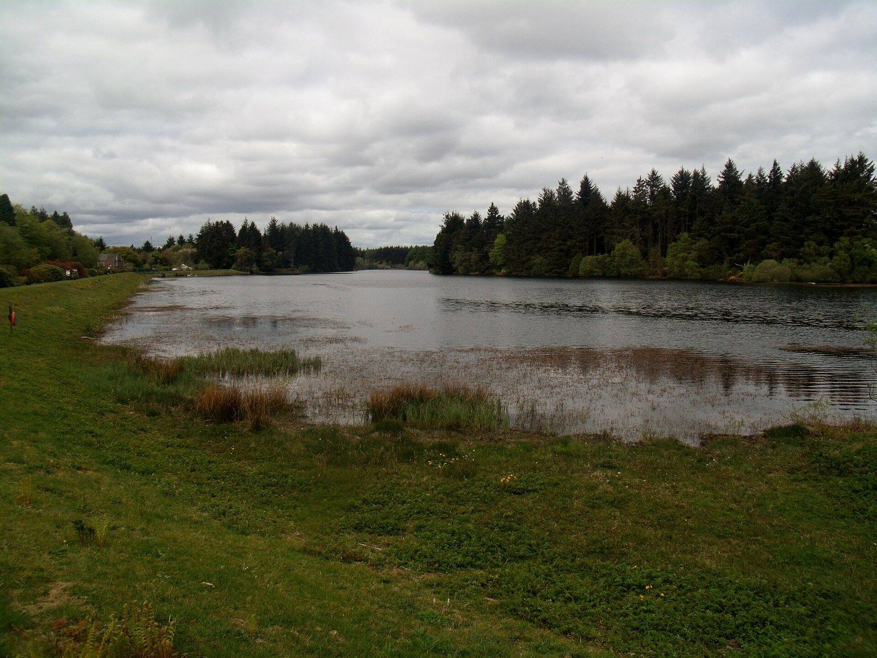
Crombie Loch was made between 1866 and 1868 to supply Dundee, sent its last water to Carnoustie in 1981 and became the centre of a country park in 1983. Mixed broadleaf and conifer woodland now rings it, and the 2.7 mile circuit from the car park follows a surfaced path past an oak leaf sculpture to the outflow, crosses a bridge and loops the western shore, with yellow thistle markers leading between the interpretation boards. Over the whole route it gains just 23 metres, so it is about as close to level as a walk in this guide gets.
There is more to look at than water. A side path climbs steps to a hide where roe deer and red squirrels are often seen, benches sit beyond a gap in a drystone dyke, and a short detour reaches a stone burial cist left by the Beaker people around 4,000 years ago. No farm animals graze here, which is rare on a list like this, but the hides and the loch edge are why most other visitors come, so a dog that is calm off the lead on the woodland paths still needs bringing close at those points. Parking is charged from April to September, and toilets are not confirmed on site.
- Distance: 2.7 miles, circular
- Difficulty: Easy, with 23 metres of climbing
- Terrain: Surfaced path and good woodland paths around the loch
- Off lead potential: Moderate, closer control near the wildlife hides
- Livestock: None
- Nearest dog beach: Carnoustie Beach, 4.1 miles
- Best for: Older dogs, puppies and anyone who likes a history lesson with their loop
Gartmorn Dam Country Park Circuit, Clackmannanshire
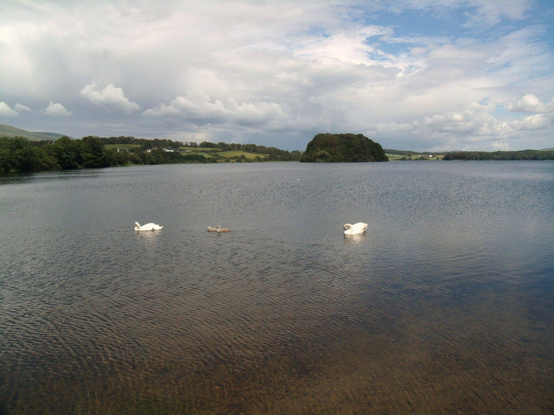
The oldest water in this guide is Gartmorn, engineered by John Erskine, the 6th Earl of Mar, and completed in 1713. Its 170 acres sit inside a 370 acre country park and nature reserve on the edge of Sauchie, near Alloa, and the reservoir is now a Site of Special Scientific Interest for its wintering wildfowl: goldeneye, whooper swans and pink-footed geese. The 2.8 mile circuit goes anti-clockwise from the old visitor centre, which is now a cafe, along the waterside with the Ochils across the water, then through the edge of a community woodland and over farmland by Sherriffyards before returning along an old colliery railway past the colliery ruins and a bird hide.
It is almost flat and on clear paths, but the water is the thing to watch. Clackmannanshire Council warns that it is deep and cold, and puts signs up when blue-green algae or thin ice appear, so check before a dog goes in anywhere. The swans and ducks gather by the car park and along the protected margins, which is where a lead earns its keep. Parking is free, though the vehicle gates are locked in the evening, and the cafe has dog parking outside.
- Distance: 2.8 miles, circular
- Difficulty: Easy
- Terrain: Lakeside path, woodland edge and farmland, suitable for all-terrain buggies
- Off lead potential: Moderate, best on the woodland stretches
- Livestock: Low
- Nearest walk: Ben Cleuch Circular from Tillicoultry, 2.1 miles
- Best for: An easy hour with a young dog and a coffee at the end
Anglezarke and Rivington Reservoir Circuit, Lancashire
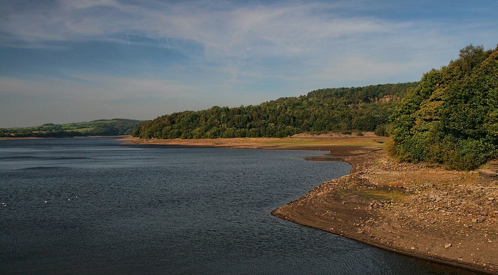 Anglezarke Reservoir – Photo Credit: Peter McDermott
A chain of reservoirs lies under the West Pennine Moors north of Bolton, and this six mile circuit treats them as the first half of a two part walk. The lower paths along the water are well surfaced and steady. Then the route leaves the shore and climbs onto open moorland, with heather, rough grass and views across Lancashire towards the coast, and the tower on Rivington Pike stays on the skyline for much of the way. Nearly all of the 290 metres of ascent comes in that one moorland section.
That split is the appeal and the warning. The waterside half gives shade, drinking stops and damp woodland full of scent between the reservoirs, and the moor opens out into ground where a dog can properly stretch. Sheep graze parts of the moor and some of the field margins by the water, however, so leads come on and off throughout and a dog that fixes on livestock will spend much of the high section attached to you. Rivington has a cafe and toilets, and the Pike and its terraced gardens make an easy extension for a dog with more to give.
- Distance: 6.0 miles, circular
- Difficulty: Moderate, 290 metres of climbing on the moorland ascent
- Terrain: Surfaced waterside paths, woodland and open moorland
- Off lead potential: Moderate, livestock on parts of the moor
- Livestock: Moderate
- Nearest walk: Rivington Pike and Terraced Gardens Circular, 1.3 miles
- Best for: A fit dog building stamina, with the option to cut the day short
Carsington Water Outer Loop, Derbyshire
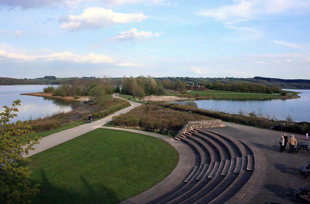 Carsington Water – Photo Credit: Des Blenkinsopp
Derbyshire's largest reservoir fills a basin of rolling country between Ashbourne and Wirksworth, and the outer loop is the full perimeter: eight miles of wide path through open grassland, strips of woodland and long waterside sections. It undulates more than most reservoir circuits, with 252 metres of climbing spread evenly across the distance, so no single hill dominates but the legs notice by the far shore. Tarmac, compacted gravel and grass alternate along the way, and the water is almost never out of view.
This is the one to choose when distance is the point. Several spots on the shoreline let a dog paddle, the reed beds and muddy margins keep a nose busy, and the quieter eastern shore, where livestock are absent, is the best stretch for letting a dog run. Moderate off lead potential is the honest rating across the whole loop, and at around three and a half hours it is a long outing for a small or elderly dog. Parking at the visitor centre costs £7 for the day, which buys access to toilets, a cafe and the Mainsail restaurant.
- Distance: 8.0 miles, circular
- Difficulty: Moderate, 252 metres of gentle undulation
- Terrain: Wide paths of tarmac, compacted gravel and grass
- Off lead potential: Moderate, best along the eastern shore
- Livestock: Low
- Nearest walk: Brassington Rocks and Harborough Rocks Walk, 1.9 miles
- Best for: A long day of steady walking with a dog that has the miles in it
Chasewater Country Park Circular, Staffordshire
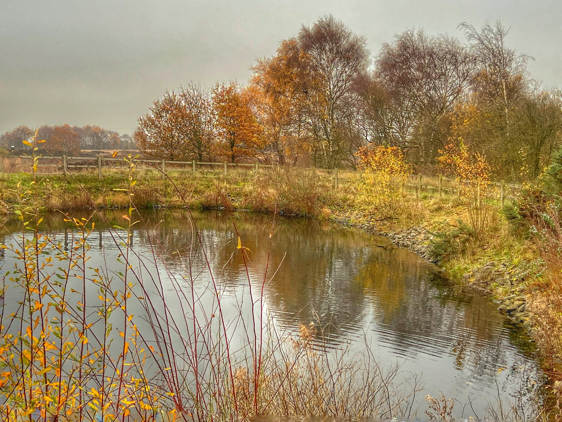
Chasewater sits across the boundary of Staffordshire and the West Midlands, a big reservoir inside a country park with a 3.1 mile trail right around the edge. The path is a mix of tarmac and compacted gravel, flat all the way and firm in every season, which makes it one of the few walks here that works as well in February as in June. Benches and points where a dog can reach the water break the circuit up, and open fields and woodland on the southern side give the most room to roam.
The off lead rating is high and no livestock graze here, but the path is shared. Cyclists use the circuit too, and in spring geese and swans nest along the open edge of the water, so the parts of the loop where a dog is closest to the shore are the parts that need the most attention. Parking at the Innovation Centre is pay and display, from £1.20 for two hours up to £3.50 for the day, and the cafe, toilets, visitor centre and a small heritage railway are all at the start.
- Distance: 3.1 miles, circular
- Difficulty: Easy
- Terrain: Flat tarmac and compacted gravel right around the reservoir
- Off lead potential: High, with care near cyclists and nesting birds
- Livestock: None
- Nearest walk: Cannock Chase Forest Trails, 6.5 miles
- Best for: A dependable all weather loop for dogs and buggies alike
Garwnant Forest and Llwyn-on Reservoir Circular, Merthyr Tydfil
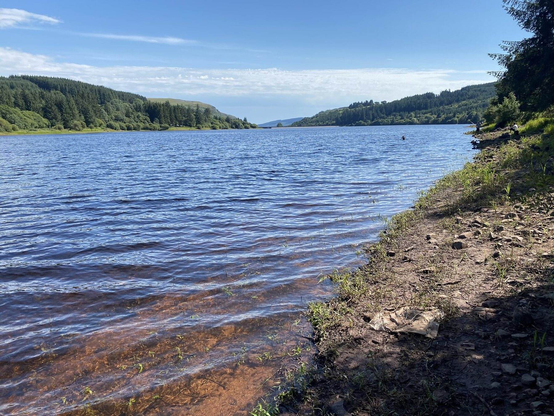
Garwnant Visitor Centre is five miles north of Merthyr Tydfil in Fforest Fawr, on the northern shore of Llwyn-on Reservoir and inside Bannau Brycheiniog, the Brecon Beacons National Park. The centre looks after around 400 acres of conifer and broadleaf woodland, and this 5.4 mile circuit climbs through it onto the moorland fringe above the water before dropping back under the trees. The 250 metres of ascent is taken gradually on forest roads and woodland paths rather than in one steep pull, and the top of the loop looks out over the reservoir to the hills of the park.
Here the woodland does more for a dog than the water. Off lead potential is high on the quieter paths away from the forest roads, the trees keep things cool on a warm day, and the only livestock tend to be occasional sheep near the moorland edge. Llwyn-on itself is a drinking water supply and not for swimming, so a dog that expects a dip at the end of a reservoir walk will not get one here. The cafe back at the centre makes up for it, with a fire, outdoor seating and water put out for dogs, alongside toilets and picnic areas.
- Distance: 5.4 miles, circular
- Difficulty: Moderate, 250 metres of gradual ascent
- Terrain: Forest roads, woodland paths and moorland fringe
- Off lead potential: High on the quieter woodland paths
- Livestock: Low, occasional sheep near the moor
- Nearest walk: Taf Fechan Horseshoe Ridge Walk, 3.1 miles
- Best for: A shaded forest walk with a good cafe waiting at the finish
Tring Reservoirs and the Grand Union Canal, Hertfordshire
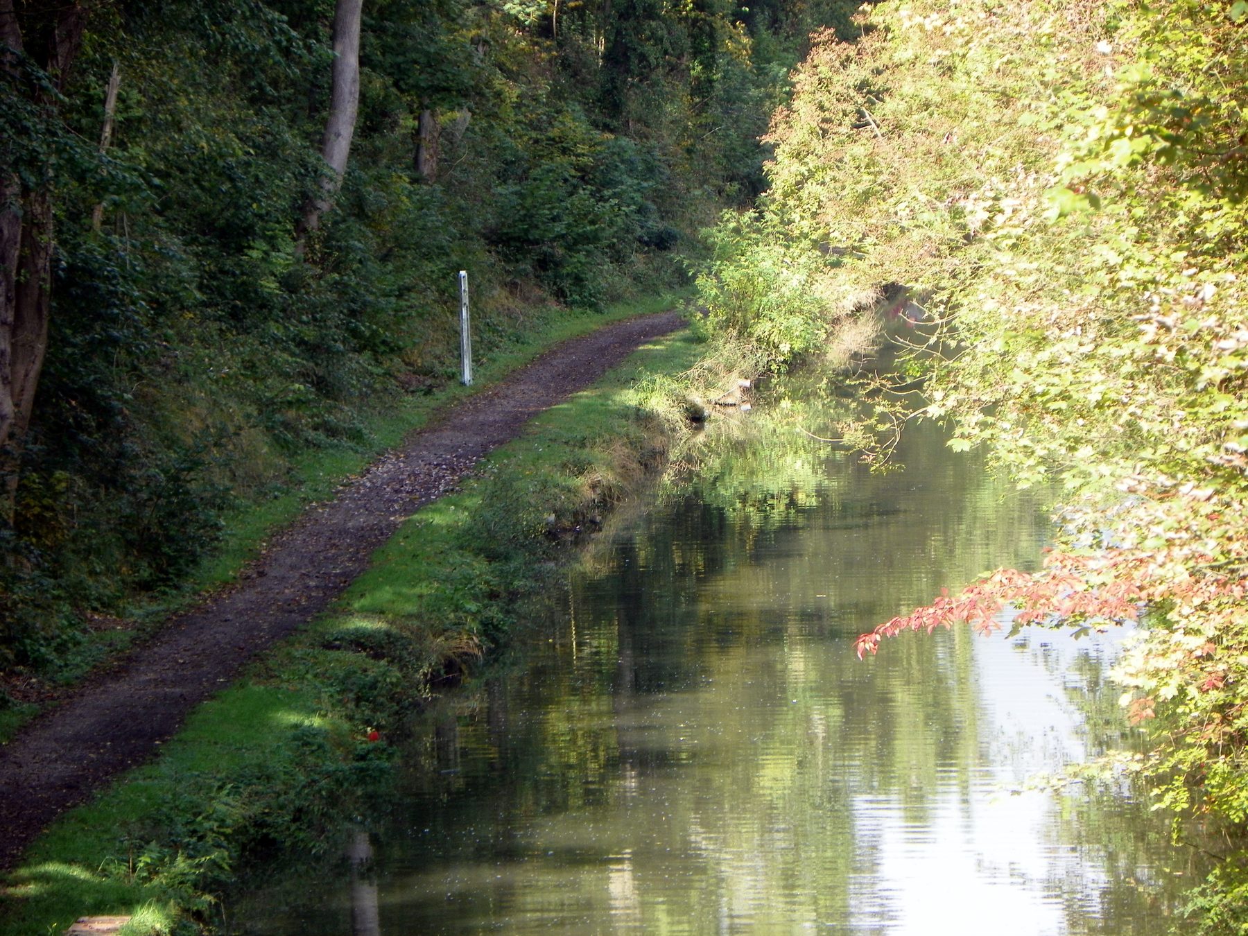
Four reservoirs at Tring were built in the 19th century to feed the summit of the Grand Union Canal, and today they are a Site of Special Scientific Interest where the birdwatchers and the narrow boats share the same banks. This four mile circuit takes in Startops End, Marsworth and Tringford, drops onto the Wendover Arm and comes back along the main line of the canal. There is barely a rise from one end to the other, and the towpath and perimeter tracks are well surfaced throughout.
It suits older and smaller dogs very well, though it is rarely a place to let one run for long. Cyclists and boats pass on the towpath, and the reedy margins hold ground-nesting birds through spring and summer, so the lead is on for a good share of the loop and off lead potential is only moderate. Herons are a regular sight. Startops End has around seventy pay and display spaces at £1.50 for three hours or £3 for the day, with toilets in season, and the Anglers Retreat on the causeway between Startops and Marsworth welcomes dogs.
- Distance: 4.0 miles, circular
- Difficulty: Easy
- Terrain: Flat, well-surfaced towpath and reservoir perimeter tracks
- Off lead potential: Moderate, leads on near boats, bikes and nesting birds
- Livestock: None
- Nearest walk: Grand Union Canal: Marsworth to Tring Reservoirs, 1.8 miles
- Best for: A level towpath amble with a pub halfway round
Avon Dam Reservoir Circular Walk, Devon
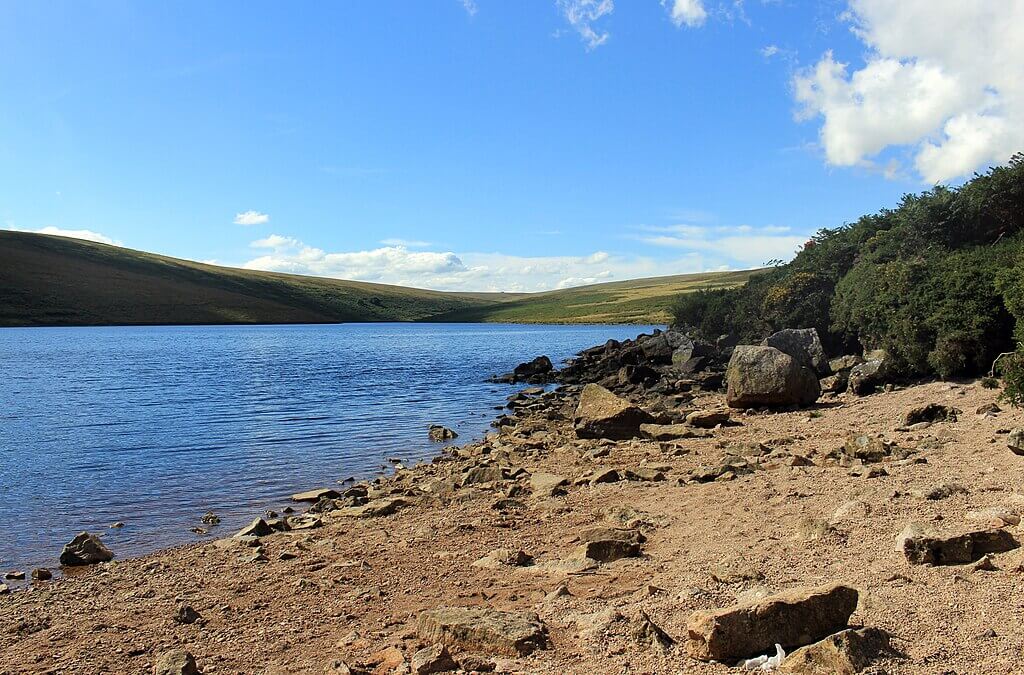 Avon Dam Reservoir – Photo Credit: Des Blenkinsopp
Avon Dam is the wildest water in this guide and the least like a country park. The approach follows the River Avon upstream from near Shipley Bridge through a valley that narrows until the concrete dam wall appears, with the reservoir held behind it and moorland rolling away above. The four mile circuit goes round the water and out onto that moor, among granite tors and rough grass, and the upper sections feel genuinely remote. It climbs 293 metres, which is a lot for the distance.
The river on the way up and the reservoir itself both give a dog somewhere to drink and cool off, and the rough, textured ground suits a dog used to natural terrain far better than one raised on pavements. The catch is Dartmoor's grazing. Ponies, sheep and cattle are all common on the open moor, livestock is rated high and off lead potential low, so a lead should be carried and used whenever animals are in sight. There are no facilities, and although the car park near Shipley Bridge is free, space at the end of the access lane is limited.
- Distance: 4.0 miles, circular
- Difficulty: Moderate, 293 metres of climbing
- Terrain: River valley, rough moorland and reservoir shore
- Off lead potential: Low, because of free-roaming livestock
- Livestock: High, with ponies, sheep and cattle
- Nearest walk: Burrator Reservoir Circular, 4.7 miles
- Best for: A short, physical outing with a fit dog on a reliable lead
Practical Advice for Reservoir Walks with a Dog
Water companies, councils and wildlife trusts manage these places for reasons that have nothing to do with dogs, and a little knowledge of those reasons makes for a smoother day:
- Look for algae signs before anyone paddles. Blue-green algae blooms in still water in warm weather and can be fatal to dogs. Gartmorn posts council notices when it appears, and it is worth reading the boards at any reservoir.
- Remember that some reservoirs are still supplying water. Llwyn-on is a drinking water source and not for swimming. Bring water for your dog rather than relying on the shore.
- Stay off dam walls and steep concrete edges. Deep, cold water beside a sheer face is a hard place for a dog to climb out of, and Clackmannanshire Council describes the water at Gartmorn as both deep and cold.
- Plan around nesting season. Tring's reed margins, Chasewater's open edge and the protected banks at Gartmorn all hold nesting or wintering birds, and spring is when leads matter most.
- Know which walks cross grazing land. Avon Dam and Anglezarke both climb onto moor with sheep, and Dartmoor adds ponies and cattle. Crombie, Chasewater and Tring have no livestock at all.
- Budget for parking. Carsington charges £7 for the day, Tring and Chasewater are pay and display, Crombie charges from April to September, while Gartmorn and Avon Dam cost nothing.
Map of Reservoir Dog Walks in the UK
The eight walks cover a long diagonal of the country, from two Scottish parks above the Forth and the Tay, through the Pennines and the Midlands, to a single dam at the bottom of Dartmoor. Open the Wildpack map to find dog friendly stays within reach of any of them, or other water-side routes near where you are staying.
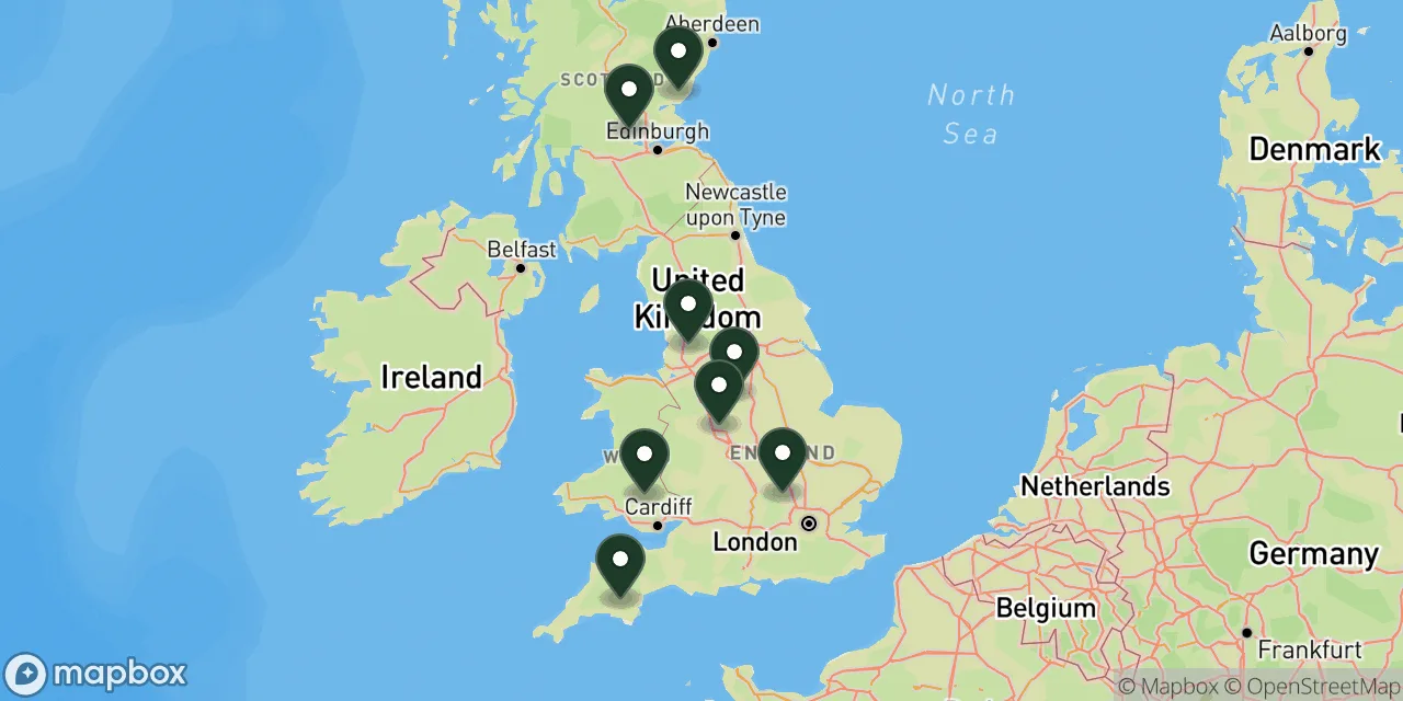 8 walks on this page
Map these walks, and thousands more
The Wildpack Map plots every dog friendly walk, beach, stay and attraction we have listed across the UK. Open it to see what else is within reach in the UK, filter by what your dog needs, and get directions to the car park.
What's Nearby?
Regional guides that take several of these walks further:
- Dog friendly walks in Derbyshire: More reservoir routes in the same county as Carsington, alongside the limestone dales.
- Dog friendly walks in Lancashire: Moorland and coast for anyone who enjoyed the climb above Anglezarke.
- Dog friendly walks on Dartmoor: Tors and forests near Avon Dam, with the same livestock rules applying.
- Dog friendly walks in the Brecon Beacons: Bigger hills in the national park that holds Garwnant.
- Dog friendly walks in Staffordshire: Cannock Chase and quieter country paths within a short drive of Chasewater.
For every route in one county, start with all dog friendly walks in Derbyshire.
Final Thoughts
Reservoir walks suit the owner who wants a predictable day: a known distance, a path that will not vanish into bog and a car park at the end. They suit older dogs, young dogs and nervous dogs better than almost any other kind of walk, and the four easy loops here, from Crombie to Tring, are as good as that category gets. What they rarely offer is real freedom, since water brings birds, anglers, cyclists and boats, and the lead spends more time on than most people expect.
If you want the gentlest outing, Crombie and Chasewater have no livestock and almost no climb. If you want distance without difficulty, Carsington is the one. And if your dog needs to come home properly tired, Anglezarke and Avon Dam both turn a reservoir walk into a moorland one, provided you are ready to hold the lead whenever there are sheep in sight.
Some links in this guide are affiliate links. We may earn a commission if you book through them, at no extra cost to you. It never affects which places we list or what we say about them.