

In the Lake District the trees are rarely the headline. People come for the fells and the water, and the woods are what you pass through on the way to a viewpoint or a shoreline. Look closer and they carry far more of the walking than the postcards suggest: ancient oak and beech around the 65 foot drop of Aira Force, sessile oak and Scots pine on the ridge of Claife Heights above Windermere, and the larch and pine of Grizedale, the largest Forestry England forest in the Lakes. These ten routes run from a 2 mile loop around Tarn Hows to a 6.8 mile walk along the eastern shore of Ullswater, all inside Cumbria.
For a dog, a Lakeland wood is shelter from the rain that the open fell never offers, a beck or a lake edge to drink from, and a floor of damp leaves that keeps a nose working the whole way round. The catch is sheep. This is working farmland almost everywhere, and the woods are often grazed or ringed by pasture, so lead rules vary enormously. Only Friar's Crag rates high for off lead walking, while at Aira Force and Lowther the lead stays on from start to finish. Each route below is taken from the Wildpack map and earns its place because trees cover a meaningful share of it. For every one you get the lead situation and one plain catch, so the choice can start with your dog rather than with the view.
Aira Force and Ullswater Viewpoints, Watermillock
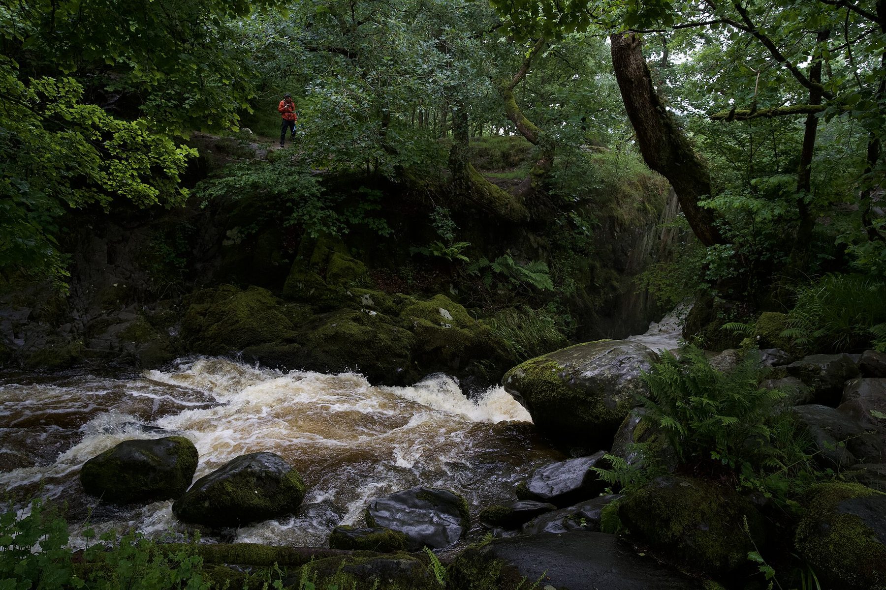
On the northern side of Ullswater, Aira Beck plunges 65 feet through ancient oak and beech, and National Trust paths thread the woods around the falls. Stone steps climb beside the beck to the falls, and from there you can carry on into Gowbarrow Park, climbing to 481 metres for a view straight down the lake to the Helvellyn skyline. Shorter waymarked loops are available, but the full circuit here is 3.1 miles, graded easy.
The Trust gives the site its top rating of three pawprints, with bowls of water set out by the visitor area and a dog friendly tearoom, but the welcome comes with a firm rule. Sheep graze the estate and ground-nesting birds breed in the parkland above the falls, so dogs stay on the lead for the entire walk. National Trust members park free at the main A592 car park, which is often full before 11am on busy days; Park Brow and High Cascades along the same road are the fallback. Grisedale Tarn and Helvellyn from Patterdale is 2.6 miles away for anyone with a fit dog and a bigger day in mind.
- Distance: 3.1 miles, circular
- Difficulty: Easy
- Terrain: Stone steps through woodland, compacted gravel path and open grass hillside
- Off lead potential: None, with sheep and ground-nesting birds across the site
- Best for: Calm lead walkers and a tearoom stop afterwards
Ullswater Lakeshore: Howtown to Patterdale

This is the one walk on the list that begins with a boat. You park at Patterdale or Glenridding, take the Ullswater Steamer to the small pier at Howtown, and walk back along the eastern shore. The path rises over Hallin Hag, drops through the farm at Sandwick, then keeps close to the water beneath Place Fell, with the Helvellyn range opening up across the lake. At 6.8 miles it is the longest route here, graded moderate, with short rocky rises but nothing technical.
The steamer takes dogs on a lead for a small extra fare, which makes the logistics easy, but the walk itself asks for patience. Nearly all of it crosses working sheep farms on open access land, and red squirrels and ground-nesting birds live in the oak woodland along the shore, so a short lead is the rule for most of the way and off lead potential is low. Spring lambing makes that stricter still. Toilets and cafes wait at both ends, and Aira Force is 2.7 miles away if you want a shorter wooded walk on another day.
- Distance: 6.8 miles, point to point by steamer
- Difficulty: Moderate
- Terrain: Rolling lakeshore path with short rocky rises, oak woodland and open pasture
- Off lead potential: Low, across working sheep farms
- Best for: Strong walkers whose dogs enjoy a boat ride
Claife Heights and Windermere Western Shore, Far Sawrey

Claife Heights is the wooded ridge on the quiet side of Windermere, and on its crest stands the restored Georgian viewing station where early tourists once looked at the lake through tinted glass. This 5.3 mile loop starts on the shoreline path from Ash Landing and climbs through sessile oak and Scots pine to the Heights, with long views over to the Troutbeck fells and the Langdales. Apart from Grizedale, it gives the longest unbroken stretch under trees on the list.
The National Trust rates it three pawprints and puts water bowls out at Ash Landing, but this is another lead-all-the-way walk. Birds nest in the woodland, the shore runs through sheep pasture, and working farms cross the Heights, so off lead potential is low. Underfoot it is mostly wide compacted path and stone track, though there are rooty patches among the trees and one steeper pull up to the viewing station. The NT car parks at Ash Landing, Harrowslack and Red Nab are free for members, and the Windermere Ferry crosses to Bowness for a pub or cafe afterwards.
- Distance: 5.3 miles, circular
- Difficulty: Moderate
- Terrain: Compacted path and stone track, rooty woodland and one short climb
- Off lead potential: Low, with sheep and nesting birds
- Best for: Owners who want a long stretch of real woodland and a ferry ride to finish
Friar’s Crag and Derwentwater Lakeshore (Keswick)
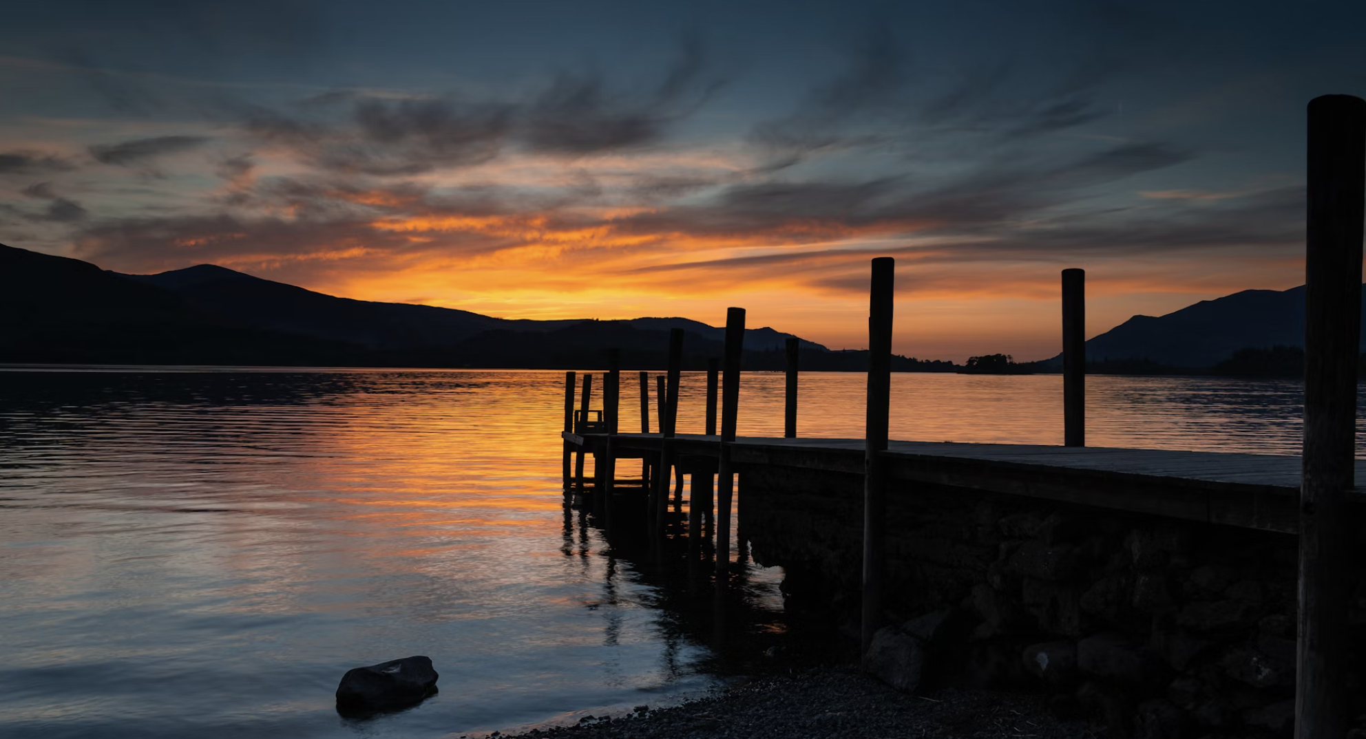
Friar's Crag is a wooded headland pushing out into Derwentwater, with views across the water to Borrowdale. This 2.8 mile loop walks south from Keswick to the crag and on along the shore, past boathouse jetties, sheltered bays and grassy clearings, then back through town. There are only about 56 metres of climbing, and oaks lean over the path along the water's edge.
This is the easiest dog walk on the list and the only one rated high for off lead potential, with plenty of places for a paddle along the shore and little livestock to worry about. The trade is company. It starts beside the Theatre by the Lake car park on the edge of a busy town, your dog goes back on the lead by the car park and in Keswick itself, and the woodland is a shoreline strip rather than a wood. For puppies, older dogs or a dog coming back from injury, that gentleness is the point. Keswick has plenty of cafes and pubs, and Latrigg Summit Walk from Keswick is 1.8 miles away for a short climb.
- Distance: 2.8 miles, circular
- Difficulty: Easy
- Terrain: Lakeside path under shoreline oaks, grassy sections and town streets
- Off lead potential: High on the open shore, leads near the car park and in town
- Best for: Puppies, older dogs and water lovers
Grizedale Forest Red Squirrel Trail

Grizedale lies between Coniston Water and Windermere and holds one of the largest red squirrel populations in the country. The Red Squirrel Trail is a waymarked 2.2 mile loop from the visitor centre through the mature larch and Scots pine where the squirrels are most often seen, passing several of the forest's outdoor sculptures. It is the only true forest walk here, with trees on every side for the whole route and no livestock at all.
That makes it the most relaxed choice for a dog that does not mix with sheep, but it is also the most managed. The path is wide gravel track with gentle gradients, so it feels more like a park trail than a wild wood, and dogs need to be kept under control because of the squirrels, ground-nesting birds and fenced sculpture areas; off lead potential is moderate. The car park charges by number plate on exit, free under 20 minutes. The visitor centre has a dog friendly cafe, toilets and water bowls, and the forest beck gives a safe paddle on a warm day.
- Distance: 2.2 miles, circular
- Difficulty: Easy
- Terrain: Wide gravel forest track with gentle gradients and short boardwalk sections
- Off lead potential: Moderate, with no livestock on the route
- Best for: Families, small dogs and dogs who are not to be trusted near sheep
Lowther Castle and Askham Village Walk

On the eastern edge of the park, this 3.7 mile loop joins the ruined shell of Lowther Castle to the sandstone cottages of Askham, following estate tracks, bridleways and the wooded banks of the River Lowther. Red squirrels and roe deer are often seen in the trees, and the open parkland looks west to the eastern Lakeland fells. It is short and level, with only a small rise past Askham Hall.
The drawback is the estate's own animals. Cattle and sheep range freely across the parkland, Highland cattle are often close to the path, and the farm fields above Askham hold livestock too, so dogs must be on a lead at all times and off lead potential is none. The woodland is limited to short sections by the river. The castle car park charges around £2 a day, the river and the village tap provide water, and the Queen's Head and the Punchbowl in Askham welcome well-behaved dogs.
- Distance: 3.7 miles, circular
- Difficulty: Easy
- Terrain: Estate tracks, grass parkland, short riverside woodland and village lanes
- Off lead potential: None, with free-roaming cattle and sheep
- Best for: History, a gentle pace and a pub lunch with a calm dog
Pooley Bridge and Dunmallard Hill Walk

Dunmallard Hill is the tree-covered knoll rising steeply over Pooley Bridge, with the remains of an Iron Age hillfort hidden under its oaks. The 2.8 mile loop leaves the village along the river, crosses the bridge, climbs through the oakwood and comes back along the lakeshore with Place Fell and the Helvellyn range in view. It is short enough for a half day and graded easy overall.
The climb up the hill is brief but steep, on rooty ground, so it is not the walk for a dog with stiff joints. The hill is open access, but it sits above working farmland with sheep and some ground-nesting birds, so leads go on off the main paths and through the pasture; off lead potential is moderate. The central pay and display car park fills on sunny weekends. Pooley Bridge has dog friendly pubs, cafes and toilets, plus the steamer pier for the lakeshore walk from Howtown, 3.2 miles away.
- Distance: 2.8 miles, circular
- Difficulty: Easy, with one short steep climb
- Terrain: Riverside path, steep rooty woodland climb and easy lakeshore return
- Off lead potential: Moderate, with leads in the pasture sections
- Best for: A short wooded climb with a lake view and cafes at the end
Stanley Force and Boot from Dalegarth
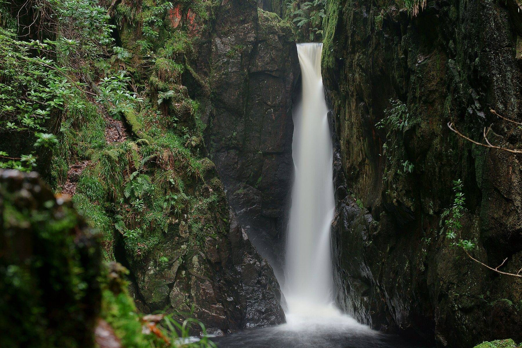
Out in quiet Eskdale, Stanley Ghyll drops through a deep, narrow ravine in a run of falls, the tallest a single leap of about 60 feet into a pool. This 4.1 mile circuit starts at Dalegarth Station, the top end of the Ravenglass and Eskdale Railway, crosses the River Esk at Trough House Bridge and climbs the wooded ghyll over a series of footbridges, among ferns and rhododendrons, to a viewpoint over the falls. It comes back past St Catherine's church and its stepping stones, over the old packhorse Doctor's Bridge and into the village of Boot.
The shallow pools of the Esk lower down are ideal for a drink or a paddle, and in the woods a dog with good recall has moderate off lead potential. The ravine is the problem: the paths in Stanley Ghyll are narrow, with steep drops close by, and rocky and slippery in places, so keep your dog close there. There are around 188 metres of climbing, and the fields around Boot and the church can hold sheep or cattle, so lead up on the farmland. Boot has an inn, though its dog policy is not verified, so check before you count on it.
- Distance: 4.1 miles, circular
- Difficulty: Moderate
- Terrain: Woodland, riverside and farmland, rocky and slippery in the ghyll
- Off lead potential: Moderate in the woods, with drops in the ravine and livestock near Boot
- Best for: Sure-footed dogs and a combined steam railway day
Tarn Hows
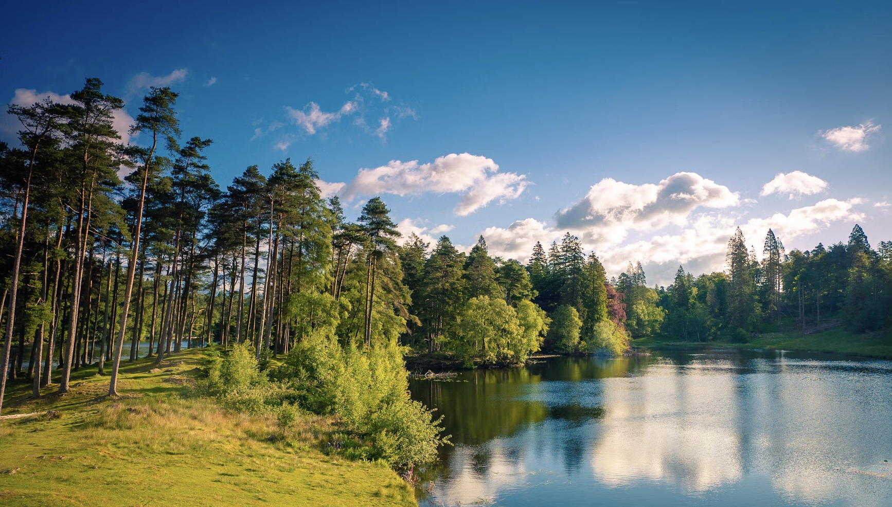
Tarn Hows is a set of linked tarns in a natural bowl of larch, pine and native broadleaves, with the Old Man of Coniston rising behind. The National Trust keeps a well-surfaced 2 mile circuit round the water, and the trees give the walk a sheltered, enclosed feel. The tarns are partly man-made: a Victorian landowner dammed three smaller pools to make the water you see today.
The firm, level path suits dogs of every age, and livestock risk is low, with moderate off lead potential and the northern side usually quieter than the busy southern approach. Several spots let a dog reach the water, but the banks are steep in places, so keep an eye on a keen swimmer. Its fame is the drawback: the car park fills quickly on summer weekends, and facilities are limited to a seasonal kiosk and toilets. For a sit-down lunch, drive to Hawkshead, where the King's Arms welcomes dogs.
- Distance: 2 miles, circular
- Difficulty: Easy
- Terrain: Firm surfaced path around the tarns through mixed woodland
- Off lead potential: Moderate, quieter on the northern side
- Best for: Older dogs, limited mobility and an early start
Wansfell Pike via Stockghyll Force, Ambleside

Wansfell Pike, at 482 metres, rises straight out of Ambleside, and this 5.6 mile loop begins in the Victorian woodland of Stock Ghyll, beside the 70 foot fall of Stockghyll Force. From the trees a pitched stone path climbs hard to a summit looking out over Windermere, before Nanny Lane drops to Troutbeck and a quiet old road leads back to town.
The woodland is only the opening act. Most of this walk is open fellside and lane, the climb is steep, and it is best saved for fit hill dogs. Sheep and cattle graze the farms along Nanny Lane and ground-nesting birds breed on the summit, so dogs stay on a short lead on the fell and the farmland, and off lead potential is low. Allow around four hours. Ambleside is full of dog friendly cafes and pubs, and Troutbeck has the Mortal Man and the Queen's Head halfway round.
- Distance: 5.6 miles, circular
- Difficulty: Moderate
- Terrain: Stone path through a wooded ghyll, steep pitched stone, grass summit and lane descent
- Off lead potential: Low, with livestock and nesting birds on the fell
- Best for: Fit dogs who want a waterfall, a summit and a pub in one loop
Practical Advice for Woodland Dog Walks in The Lake District
- Assume sheep until you know otherwise: seven of these ten walks cross grazed land, and on several the lead stays on for the whole route. Grizedale is the only one with no livestock at all.
- Ground-nesting birds change the rules: at Aira Force, Claife Heights, the Howtown shore and Wansfell Pike they are part of the reason for keeping dogs on a lead, in the parkland, the oakwoods and on the summit.
- Use the National Trust car parks early: Aira Force, Claife Heights and Tarn Hows are all NT sites, free for members, and the busiest fill by late morning on fine days.
- Know where the water bowls are: Aira Force, Ash Landing on Claife Heights and the Grizedale visitor centre all put them out, which helps on the longer loops.
- Check boats and trains before you go: the Ullswater Steamer carries dogs on a lead for a small fare, and Stanley Force starts at the Eskdale terminus of the Ravenglass and Eskdale Railway.
- Watch your dog's footing near water: the banks at Tarn Hows are steep in places, and the ravine path at Stanley Ghyll runs close to drops.
Map of Woodland Dog Walks in The Lake District
On the map the ten split into three groups and two outliers. Aira Force, Pooley Bridge, the Howtown shore and Lowther gather around Ullswater and the eastern edge of the park. Claife Heights, Grizedale, Tarn Hows and Wansfell Pike fill the southern lakes between Windermere and Coniston. Friar's Crag stands on its own by Keswick in the north, and Stanley Force sits far out west in Eskdale. The Wildpack map shows where to stay with a dog and what else to walk near each group.
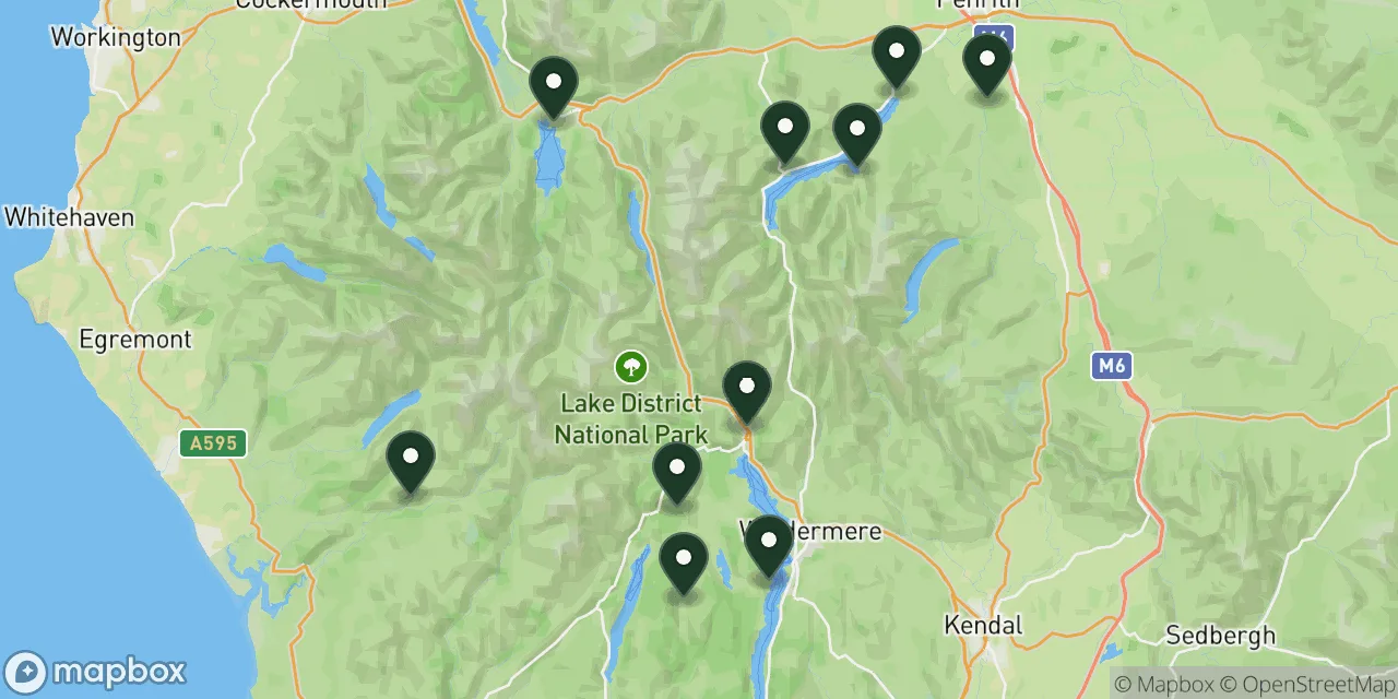 10 walks on this page
Map these walks, and thousands more
The Wildpack Map plots every dog friendly walk, beach, stay and attraction we have listed across the UK. Open it to see what else is within reach in The Lake District, filter by what your dog needs, and get directions to the car park.
What's Nearby?
If these woods have you planning more time in Cumbria, these guides are the natural next step:
- Best dog walks in the Lake District: The big fell routes, from Cat Bells to Helvellyn, for when your dog wants height rather than shade.
- Waterfall walks you can take a dog on: More falls like Aira Force, with river and woodland paths across the country.
- Dog friendly cottages near the best walks in Cumbria: A base within reach of the trailheads, so the walk starts from the door.
- Dog friendly campsites in the Lake District: Pitches close to the lakes for owners who prefer canvas.
- Woodland dog walks in the Peak District: The same idea further south, with oak gorges and old coppice.
For every dog walk in the area, browse the Lake District or Cumbria.
Final Thoughts
The Lake District's woods suit owners who can live with a lead. If your dog needs to run, Friar's Crag gives the most freedom, with Tarn Hows and the Eskdale woods next, and Grizedale is the safe choice for a dog that cannot be trusted near sheep. If you want a long woodland climb with a view, walk Claife Heights; if you want falling water, go to Aira Force or Stanley Force.
For a puppy or an older dog, Tarn Hows and Friar's Crag ask the least. And for a single day that has everything, take the steamer to Howtown and walk the shore of Ullswater back to Patterdale, with the oaks on one side and the lake on the other.
Some links in this guide are affiliate links. We may earn a commission if you book through them, at no extra cost to you. It never affects which places we list or what we say about them.