

A waterfall gives a walk something most routes lack, which is an ending. These twelve are less about height than about the ground on the way there, and on several the falls are the least of it: a three-wire bridge across the Water of Nevis below Steall, wooden boardwalks hung over the gorge at Glenariff, a shallow sandstone recess you can stand behind at Gibson's Cave in Teesdale. They run from a 1.2 mile amble to a nine mile circuit around Loch Lee, across Wales, England, Scotland and Northern Ireland.
For a dog the appeal is the water itself, plus the scent of wet moss and leaf mould that comes with it. The difficulty is that waterfalls collect the things owners worry about: narrow paths above drops, slippery rock, and sheep grazing the slopes either side of the gorge. Each walk below was picked from our map of walks because the route reaches falling water, and each comes with its lead rules stated plainly, so you can match the walk to your dog before you match it to the view.
Aber Falls to the Foothills Loop (Abergwyngregyn), Gwynedd
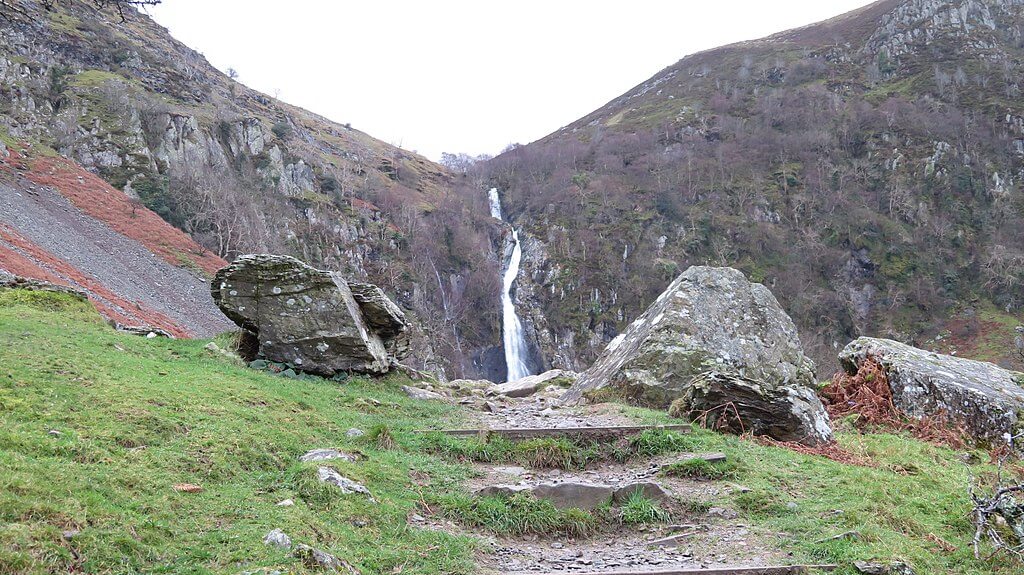 Photo Credit: Llywelyn2000
This loop takes the familiar track from Abergwyngregyn up the valley to Aber Falls and then keeps going, climbing through bracken and scattered rock onto open hillside with the Carneddau ridge across the way. The result is a walk of two halves over 4.3 miles: a well-made riverside track on the way out, then a steeper, more exposed return over the foothills that drops back down to the falls before retracing the valley path.
It is a fine walk, but sheep graze the valley floor and the upper slopes alike, so the lead stays on for the whole two hours and off lead potential is rated low. The foothills stretch is uneven and turns muddy after rain, which suits a dog used to rough ground better than one used to pavements. Parking is the other catch: two small paid car parks hold about thirty cars between them at £5, with free alternatives nearby, and there are toilets at the upper one. If the full loop is too much, the shorter Aber Falls (Rhaeadr Fawr) route starts 1.2 miles away.
- Distance: 4.3 miles, circular
- Difficulty: Moderate
- Terrain: Riverside track, then rough foothill path
- Off lead potential: Low, with livestock throughout
- Best for: Fit dogs who can handle a steep, muddy second half
Aira Force and Ullswater Viewpoints, Cumbria
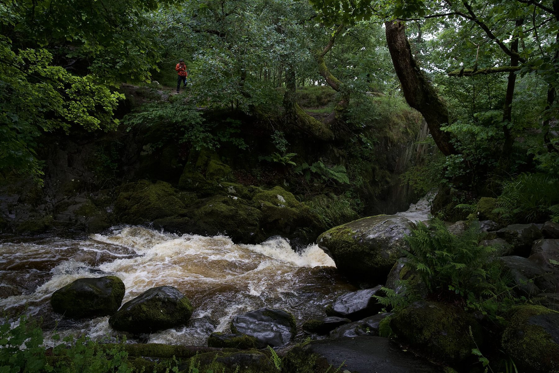
Aira Force drops 65 feet through old oak and beech above Ullswater, and the National Trust paths around it link the falls to Gowbarrow Park, whose 481 metre top looks down the length of the lake towards Helvellyn. Waymarked options run from half a mile to two miles, and the whole 3.1 mile circuit is graded easy, on woodland steps, compacted gravel and open grass. The Trust gives the site three pawprints, there are water bowls in the visitor area, and dogs are welcome at the tearoom.
All of that hospitality comes with a firm rule: dogs stay on a lead throughout, because sheep graze the site and the parkland above the falls holds ground-nesting birds. Off lead potential is none. The main car park on the A592 is free for members but fills before 11am on busy days, so arrive early or use Park Brow or High Cascades along the road. For a bigger day, the Grisedale Tarn and Helvellyn route starts 2.6 miles away at Patterdale.
- Distance: 3.1 miles, circular
- Difficulty: Easy
- Terrain: Stone steps through woodland, compacted gravel and open grass hillside
- Off lead potential: None
- Best for: Owners who want a tearoom, water bowls and a lake view in one morning
Carding Mill Valley, Shropshire
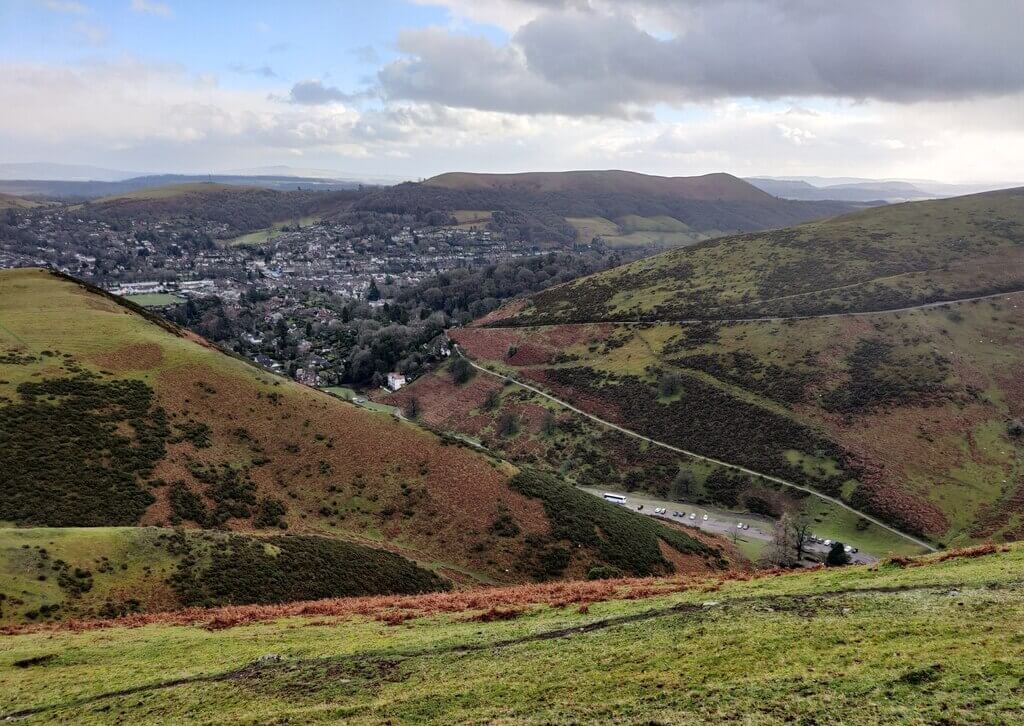 Photo Credit: Mat Fascione
Carding Mill Valley leaves Church Stretton gently, following a stream up a sheltered valley floor, then climbs 423 metres onto the Long Mynd plateau where the ground turns to heather, bilberry and rough grass. The waterfalls here are small ones, where streams spill off the edge of the plateau, so treat them as incidents along the way rather than the reason to come. What you get instead is a 6 mile circuit that descends by a different valley, with wide views across Shropshire from the top.
Livestock graze across the Long Mynd, so off lead potential is low and sheep awareness matters all the way round. The stream in the valley bottom gives a drink and a cool-off on the climb, but the plateau is exposed and can be harsh in poor weather, so pick a fair day or come ready for wind and rain. The National Trust car park, cafe, toilets and shop sit at the start, and Caer Caradoc from Church Stretton begins just 0.1 miles off for a second day.
- Distance: 6.0 miles, circular
- Difficulty: Moderate
- Terrain: Moorland and heathland after a valley start
- Off lead potential: Low
- Best for: Strong dogs who like a sustained climb and open, windy tops
Glen Nevis River Walk and Steall Falls, Highlands
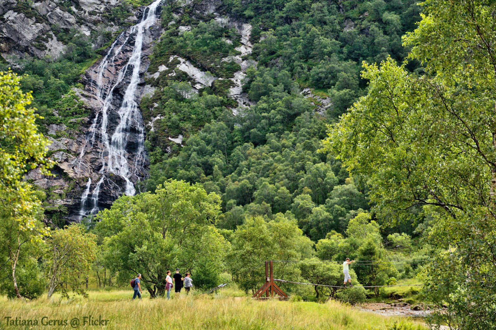
From the upper car park in Glen Nevis the path enters a gorge of mixed woodland with the Water of Nevis crashing through a narrow channel far below, then opens into Steall Meadow, a flat grassy bowl ringed by mountain ridges. Steall Falls, the second highest waterfall in Scotland, comes down 120 metres in a single curtain at the far side, and a three-wire bridge crosses the river towards its base. The whole out and back is 3.5 miles.
The distance is modest, though the gorge path is narrow, with steep drops to the river, and needs care when wet, so dogs go on leads for that section. The meadow is where this walk earns its place: wide, flat and largely free of livestock, with cold, clear water for swimming. Toilets and basic facilities are at the Glen Nevis Visitor Centre lower down the glen, and Ben Nevis via the Mountain Track starts 0.2 miles away.
- Distance: 3.5 miles, out and back
- Difficulty: Moderate
- Terrain: Gorge, woodland and riverside
- Off lead potential: Moderate, in Steall Meadow
- Best for: Swimmers and dogs who need a proper run at the end of the path
Glenariff Forest Park and Waterfall Trail, Northern Ireland
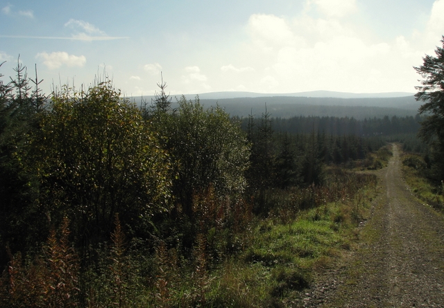 Photo Credit: Ross
Glenariff's Waterfall Trail is laid on timber boardwalks that take you above fast water through a steep-sided gorge, past the Ess-na-Larach and Ess-na-Crub falls. Spray hangs in the air under a dense canopy, and beyond the gorge the wider forest trails slow the pace through mature woodland. The core loop is an easy 2 miles, and you can stretch it to around 8 kilometres by combining trails.
The boardwalks narrow where they hang over the gorge, so leads are sensible there even though off lead potential on the wider forest tracks is moderate. Livestock risk is low, the terrain suits dogs of most fitness levels, and the car park is charged, with a visitor centre, cafe and toilets. A dog that reacts to water noise will find this the most intense hour on the list. Afterwards, Waterfoot Beach is 2.5 miles away on the coast.
- Distance: 2.0 miles, circular
- Difficulty: Easy
- Terrain: Woodland and riverside boardwalk
- Off lead potential: Moderate on the forest trails
- Best for: Dogs of mixed ages, with a beach to finish on
Ingleton Waterfalls Trail, North Yorkshire
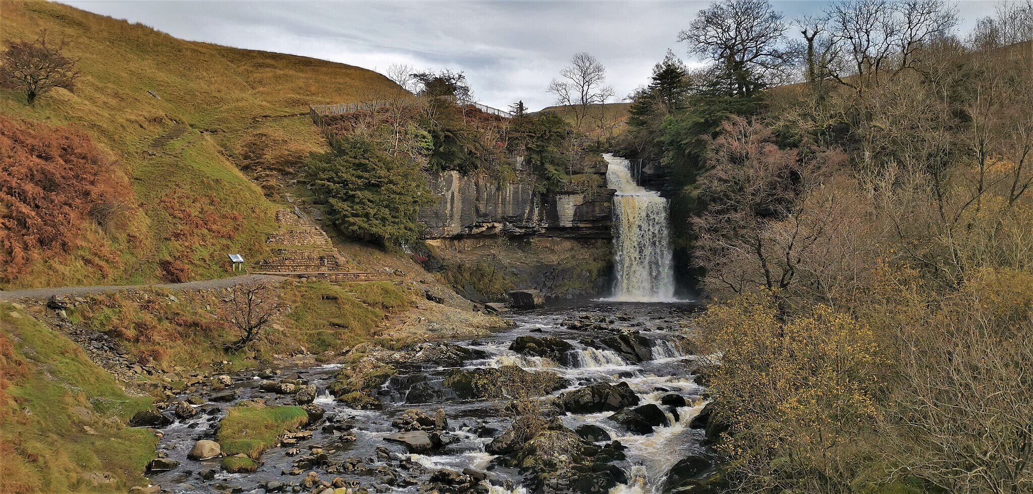 Photo Credit: Chris Morgan
No route here strings together more falls. The Ingleton trail runs one way through two limestone gorges on the Rivers Twiss and Doe: up past Pecca Falls to Thornton Force, a clean 14 metre drop over a cliff, then across open ground and down the Doe past Beezley Falls, the viewing bridge over Baxenghyll Gorge, and Snow Falls. It is 4.3 miles from Broadwood Car Park and back, mostly well surfaced, through moss-covered rock and hanging woodland.
It is also privately run, and it charges: about £11 for an adult and £5 for a child, card only, with parking included. Dogs are welcome but must be on leads for the whole trail, and some stepped, rocky sections rule it out for dogs that struggle on uneven ground. Oddly for a walk beside two rivers, water access from the path is limited, so pack a bowl and a bottle. There is a cafe and toilets at the start, and a kiosk at Beezley Farm that only opens at weekends and in summer.
- Distance: 4.3 miles, circular
- Difficulty: Moderate
- Terrain: Riverside and woodland, with stepped rocky sections
- Off lead potential: Low, leads required by the trail
- Best for: Owners who want six named falls in a single morning and don't mind paying for it
Manifold Valley Trail, Derbyshire
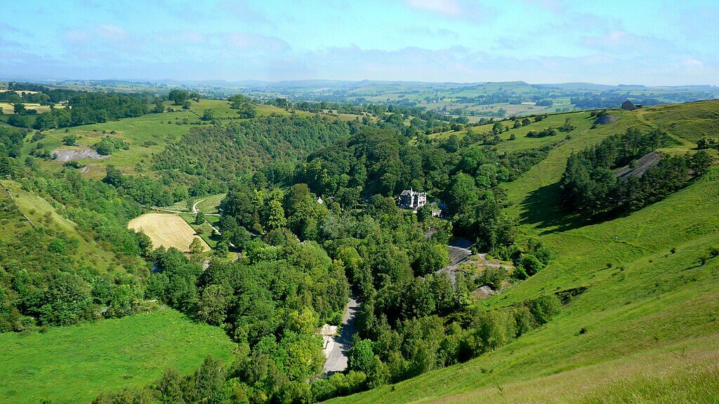 Photo Credit: Mark Percy
The Manifold Valley is the odd one out on this list. There is no headline fall to walk towards; the draw is a river that vanishes. In dry weather the River Manifold sinks into the porous limestone and runs underground before surfacing again downstream. The 5 mile circuit follows the old Leek and Manifold Light Railway trackbed along the valley floor, under tree-lined slopes, past the stone packhorse bridge at Wetton Mill and up to Thor's Cave, a natural arch set high in the cliff.
Livestock graze the valley sides and the fields along the route all year, so leads stay on for most of it. The old railway surface is firm underfoot, but the climb to Thor's Cave is rocky and steep, and where the river runs underground there is nothing to drink, so carry water for the upper sections. In its favour, the valley is sheltered and dries out quickly after rain, which makes it a sound choice on a mixed day. The seasonal cafe at Wetton Mill welcomes dogs outside.
- Distance: 5.0 miles, circular
- Difficulty: Moderate
- Terrain: Limestone valley and farmland
- Off lead potential: Low
- Best for: A sheltered walk with a cave and a disappearing river when the weather is unsettled
Angus Glens: Glen Esk Waterfall Walk
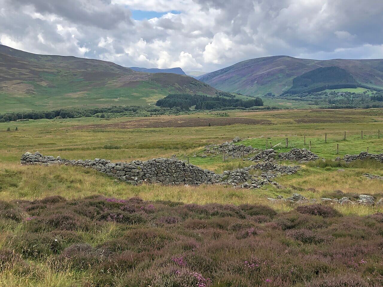
This is the longest walk on the list, and it gives a dog the most space. From the free car park at Invermark, where the public road in Glen Esk ends, an estate track circles Loch Lee beneath tall hillsides before climbing into Glen Lee. There the Falls of Unich pour over a rock step, and the Falls of Damff sit higher up in a corrie of their own. It is a wild-feeling 9 miles with about 250 metres of climbing and no summit to bag.
The upper section is usually free of stock, so a dog can run there, but sheep graze heavily at the start and again lower down, so lead up past the farm buildings. Allow four hours. There is nothing on the route itself: the nearest toilets and cafe are at the Glenesk Retreat and Folk Museum, a short drive back and open only in season, so take water and food. The track gives way to rougher hill path and a few rocky steps around the falls.
- Distance: 9.0 miles, circular
- Difficulty: Moderate
- Terrain: Wide estate tracks, rougher hill path at the falls
- Off lead potential: High, away from the sheep
- Best for: A full day out with a dog that has the legs for nine miles
Aros Park and Tobermory Coastal Circuit, Argyll and Bute
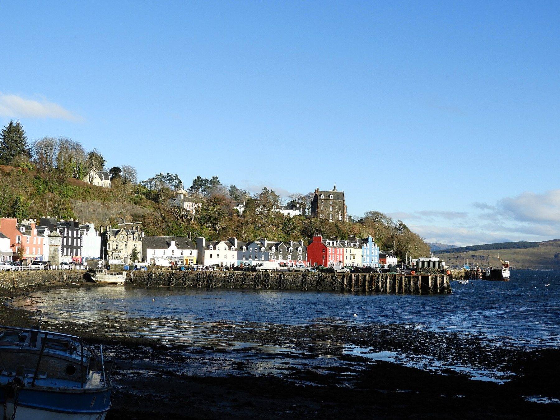
Starting at Ledaig car park at the end of Tobermory's harbour front, this 3.4 mile loop climbs behind the Taigh Solais building for a look back over the painted houses, then follows a coastal path through old Scots pines into Aros Park, a former estate woodland. It passes the Sput Dubh cascade and zig-zags down steps to a footbridge below the main Aros waterfall, which thunders into the sea after rain, before circling Loch a'Ghurrabain, covered in waterlilies in summer.
There is no livestock in the woods, and dogs can come off the lead once you are clear of town, but the coastal path has a steep drop on one side in places, and the steps and muddy patches add up over 142 metres of climbing. Keep dogs close around the busy Aros car park, play area and picnic spots. One timely caveat: Forestry and Land Scotland began felling in part of the park on 31 August 2026, with short daytime closures of the coastal link, so check the signs before you set off. Toilets are at Taigh Solais by the start.
- Distance: 3.4 miles, circular
- Difficulty: Moderate
- Terrain: Woodland, coastal path and lochan shore
- Off lead potential: Moderate
- Best for: A Mull morning that ends back in town for lunch
Bowlees and the Gibson's Cave Trail, County Durham
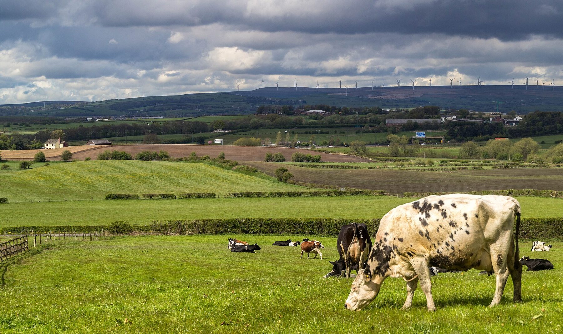
At 1.2 miles there and back, this is the gentlest walk on the list. A path of compact earth and stone follows Bowlees Beck up a wooded valley of mossy boulders, with primroses in spring, to Summerhill Force and the shallow sandstone recess behind it called Gibson's Cave. It takes about 45 minutes, which makes it the right size for small legs and older dogs, and for anyone who wants a taste of Teesdale without the miles.
The final approach is the part to watch. The rocks by the cave are always damp and the stepping stones across the beck get slippery, so clip the lead on there. The wooded valley has no stock, but the fields on the walk in hold sheep. The donate-and-display car park at Bowlees Visitor Centre takes around forty cars, with a cafe and toilets, and if your dog has more in the tank, High Force Waterfall and Teesdale Walk starts just 0.2 miles away.
- Distance: 1.2 miles, out and back
- Difficulty: Easy
- Terrain: Compact earth and stone, stepping stones and a short rise to the cave
- Off lead potential: Moderate
- Best for: Puppies, older dogs and short winter afternoons
Bracklinn Falls, Stirling
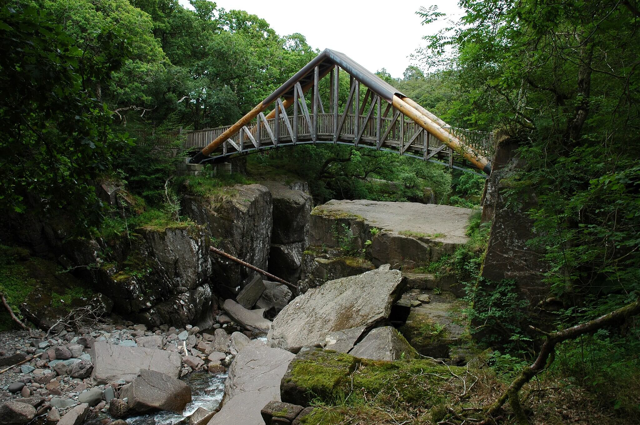
Bracklinn Falls is on the Keltie Water above Callander, at the edge of the Trossachs. The 2.5 mile circuit climbs steadily through oak, birch and alder beside water-worn rock before the falls force their way through a narrow cleft, with a bridge across the gorge at the main viewpoint. The paths are well kept and the gradient is gentle, so most dogs of most ages will manage it in about an hour and a quarter.
The burn gives plenty of paddling on the way up and the falls throw out cooling spray, but the narrow path along the gorge edge has serious drops, and that is where a lead belongs even though the woodland elsewhere offers moderate off lead potential. Livestock are largely absent. The trailhead car park is free, Callander has dog friendly cafes and pubs including The Lade Inn, and Callander Crags Circular Walk is 1.3 miles off if you want a viewpoint as well.
- Distance: 2.5 miles, circular
- Difficulty: Easy
- Terrain: Woodland and riverside paths
- Off lead potential: Moderate, lead at the gorge edge
- Best for: A short, dramatic outing with a pub lunch in town
Dartmoor: Becky Falls and Manaton Circular, Devon
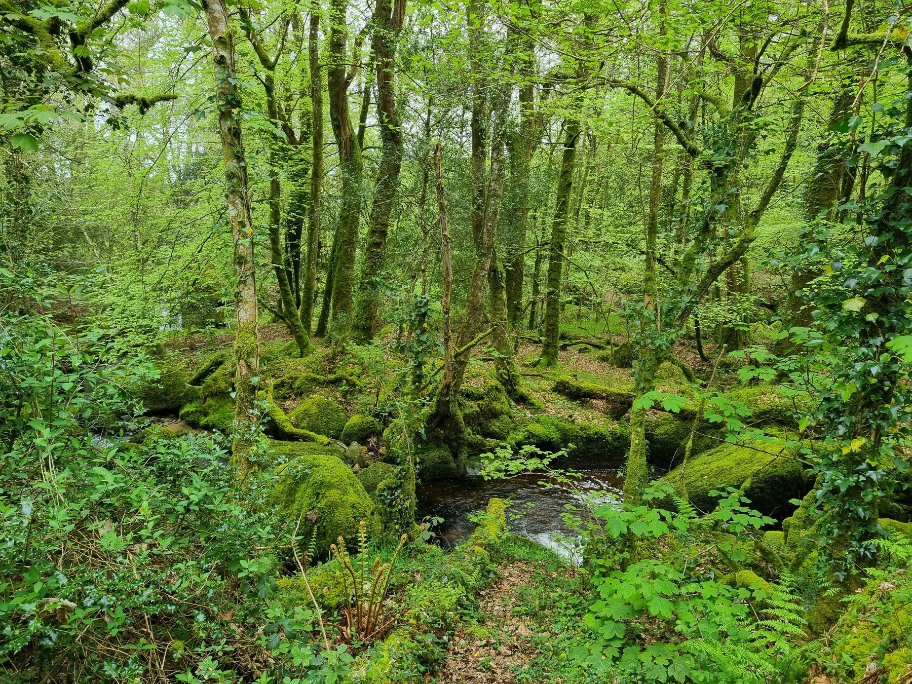
From the green at Manaton this 4.8 mile loop climbs over the granite stack of Bowerman's Nose, crosses to the medieval ruins below Hound Tor and returns through ancient oak woodland near Becky Falls. It mixes open moor, tors and trees in one circuit, with short stream crossings and a couple of short steep climbs.
Be clear about what you are getting: Becky Falls is a private attraction with its own admission and dog welcome, and this route stays on the public footpaths in the woods nearby rather than going into the falls site. On the moor, sheep, cattle and Dartmoor ponies graze freely, and from 1 March to 31 July any dog on access land has to be kept on a fixed lead no longer than 2 metres. Parking is free on the green, and the dog friendly Kestor Inn is waiting at the end. The Haytor and Hound Tor Circular covers neighbouring ground 2.8 miles away.
- Distance: 4.8 miles, circular
- Difficulty: Moderate
- Terrain: Granite moor, oak woodland tracks and stream crossings
- Off lead potential: Moderate, outside 1 March to 31 July
- Best for: Tor walkers who want a wooded descent and a pub at the finish
Practical Advice for Waterfall Walks With a Dog
Water, height and wet rock make waterfall walks a little different from a normal day out. Before you go:
- Plan the lead around the gorge, not the map. At Glen Nevis, Bracklinn Falls and the Aros coastal path the drops are where leads matter most, whatever the off lead rating says.
- Expect wet rock to be slippery. The stepping stones below Gibson's Cave and the gorge path at Glen Nevis are the obvious ones.
- Check the land rules. Aira Force and the Ingleton trail are lead-only throughout, and on Dartmoor access land a 2 metre fixed lead is the law from 1 March to 31 July.
- Carry water even beside a river. Ingleton's path keeps the water out of reach, the Manifold disappears underground in dry spells, and Glen Esk has no facilities on the route.
- Budget for entry and parking. Ingleton costs about £11 per adult, card only, and Aira Force's car park fills before 11am on busy days.
- Look for closures. Felling work in Aros Park means short daytime closures of the coastal link.
Map of Waterfall Walks You Can Take a Dog On
Plotted together, the twelve run from Dartmoor in the south to Glen Nevis and Glen Esk in the north, with Mull and the Antrim glens off to the west and a band through the Pennines from the Manifold to Teesdale. Open the Wildpack map to see the dog friendly stays, beaches and other walks close to whichever falls you pick.
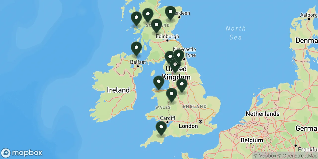 12 walks on this page
Map these walks, and thousands more
The Wildpack Map plots every dog friendly walk, beach, stay and attraction we have listed across the UK. Open it to see what else is within reach in UK, filter by what your dog needs, and get directions to the car park.
What's Nearby?
If one of these walks appeals, these guides go further:
- Best dog walks in the Lake District: For more fell and lake routes around Ullswater once you have seen Aira Force.
- Best dog walks in the Yorkshire Dales: Limestone country to explore beyond the Ingleton trail.
- Best dog walks in Snowdonia: Bigger mountain days a short drive from Aber Falls.
- Dog friendly walks in Loch Lomond and the Trossachs: The wider national park around Callander and Bracklinn Falls.
- Best dog walks in Northern Ireland: Coast and mountain routes to pair with Glenariff.
To see every dog walk in one area, start with North Yorkshire or the Highlands.
Final Thoughts
A good waterfall walk with a dog is one where the falls are a reward rather than a hazard, and the best of these manage that balance: Steall Meadow's open grass after the gorge, the gentle wooded mile to Gibson's Cave, the long free-running stretch above Loch Lee. They suit owners who are happy to clip the lead on at the edges and let go where the ground opens out.
With a puppy or an older dog, start at Bowlees or Bracklinn Falls. A dog that swims should go to Glen Nevis, and one that needs a whole day of miles belongs in Glen Esk. If the falls themselves are the point and you will happily keep the lead on, Ingleton gives you the most water for your money, while Aira Force is the one to choose when the tearoom matters as much as the view.
Some links in this guide are affiliate links. We may earn a commission if you book through them, at no extra cost to you. It never affects which places we list or what we say about them.